Latitude: 53.6555 / 53°39'19"N
Longitude: -1.7522 / 1°45'7"W
OS Eastings: 416476
OS Northings: 417694
OS Grid: SE164176
Mapcode National: GBR JV65.GB
Mapcode Global: WHCB2.1CXZ
Plus Code: 9C5WM64X+54
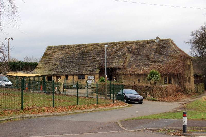
Entry Name: Nether Hall Barn
Listing Date: 18 July 1975
Grade: II
Source: Historic England
Source ID: 1231771
English Heritage Legacy ID: 406995
ID on this website: 101231771
Location: Rawthorpe, Kirklees, West Yorkshire, HD5
County: Kirklees
Electoral Ward/Division: Dalton
Parish: Non Civil Parish
Built-Up Area: Huddersfield
Traditional County: Yorkshire
Lieutenancy Area (Ceremonial County): West Yorkshire
Church of England Parish: Rawthorpe St James
Church of England Diocese: Leeds
RAWTHORPE LANE 1. 5113 Rawthorpe Nether Hall Barn SE 1617 29/1137 18.7.75. II 2. C18 or older. Hammer dressed stone. Pitched stone slate roof, half-hipped at south end. Aisled timber construction with arch braces and wind braces to arcade plates. Planked double doors in barn porch on west side. Various 3 and 2-light stone mullioned windows.
Listing NGR: SE1647617694


Other nearby listed buildings