Latitude: 53.3573 / 53°21'26"N
Longitude: -2.0399 / 2°2'23"W
OS Eastings: 397440
OS Northings: 384491
OS Grid: SJ974844
Mapcode National: GBR GY6M.56
Mapcode Global: WHBB4.MWT3
Plus Code: 9C5V9X46+W2
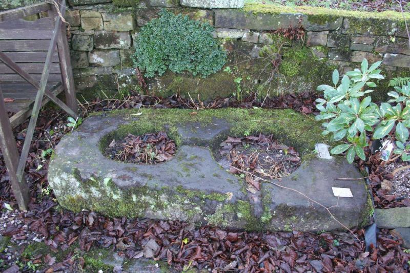
Entry Name: Crossbase in Churchyard
Listing Date: 17 November 1983
Grade: II
Source: Historic England
Source ID: 1231677
English Heritage Legacy ID: 406852
ID on this website: 101231677
Location: St Mary's Church, Disley, Cheshire East, Cheshire, SK12
County: Cheshire East
Civil Parish: Disley
Built-Up Area: New Mills
Traditional County: Cheshire
Lieutenancy Area (Ceremonial County): Cheshire
Church of England Parish: Disley St Mary
Church of England Diocese: Chester
SJ 97 84 DISLEY C.P. RED LANE (South Side) 7/42 Crossbase in Churchyard
GV II
Socket stone for two crosses: Pre-conquest but found at SJ 9738 8444 in 1958. Massive sub-rectangular stone slab with 2 circular holes of different sizes. Shallow grooves run through the centres of these holes and perpendicular to them, a piece of lead is set into one of them. Thought to be the setting for 2 Anglo-Saxon crosses now lost. (Trans. Lancs. and Ches. Ant. Soc. vol 58, 142).
Listing NGR: SJ9744084491


Other nearby listed buildings