Latitude: 53.2061 / 53°12'22"N
Longitude: -2.3438 / 2°20'37"W
OS Eastings: 377135
OS Northings: 367730
OS Grid: SJ771677
Mapcode National: GBR 008.VNM
Mapcode Global: WH99M.ZN2Y
Plus Code: 9C5V6M44+FF
Entry Name: Twemlow Viaduct
Listing Date: 12 March 1987
Grade: II
Source: Historic England
Source ID: 1231669
English Heritage Legacy ID: 406844
ID on this website: 101231669
Location: Cheshire East, Cheshire, CW4
County: Cheshire East
Civil Parish: Holmes Chapel
Built-Up Area: Holmes Chapel
Traditional County: Cheshire
Lieutenancy Area (Ceremonial County): Cheshire
Church of England Parish: Church Hulme (or Holmes Chapel) St Luke
Church of England Diocese: Chester
Tagged with: Railway viaduct
TWEMLOW C.P. SJ 76 NE
4/51 Twemlow Viaduct
-
GV II
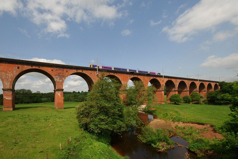
Railway viaduct 1841 by G W Buck, Engineer to Manchester and Birmingham Railway Company. Red brick, in English Bond, and sandstone. Twenty three semi-circular arches, each of 18 metres span, supported on 3 metres on face by 8 metres deep piers. Projecting pier plinths with weathered vermiculated stone cornice, mainly in brickwork but the plinths of the two piers nearest to the River Dane are wholly of stone with banded rustication. Ogee moulded stone impost bands. 8 bricks deep arches, some wholly in brick-on-edge rings. The plain stone parapet sits on a projecting two course deep brick band;this is supported by a cornice which is built-up from a chamfered stone band and a massive dentil cornice. The viaduct carries the electrified railway from Manchester to Crewe.
Listing NGR: SJ7713567730
External links are from the relevant listing authority and, where applicable, Wikidata. Wikidata IDs may be related buildings as well as this specific building. If you want to add or update a link, you will need to do so by editing the Wikidata entry.


Other nearby listed buildings