Latitude: 50.986 / 50°59'9"N
Longitude: -1.5062 / 1°30'22"W
OS Eastings: 434758
OS Northings: 120849
OS Grid: SU347208
Mapcode National: GBR 75F.40M
Mapcode Global: FRA 76QH.YW8
Plus Code: 9C2WXFPV+CG
Entry Name: 7, the Causeway
Listing Date: 4 December 1972
Grade: II
Source: Historic England
Source ID: 1231608
English Heritage Legacy ID: 406766
ID on this website: 101231608
Location: Romsey, Test Valley, Hampshire, SO51
County: Hampshire
District: Test Valley
Civil Parish: Romsey Extra
Built-Up Area: Romsey
Traditional County: Hampshire
Lieutenancy Area (Ceremonial County): Hampshire
Church of England Parish: Romsey St Mary and St Ethelflaeda
Church of England Diocese: Winchester
Tagged with: Building
THE CAUSEWAY 1. ------------ 1559 No 7
SU 3420 2/119
II GV
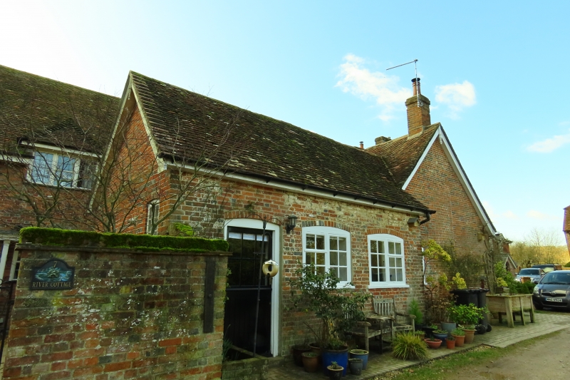
2. C18. 1-storey and attic. Brick. Old tile roof. 2 windows on ground floor with panelled shutters. 6-panel door to south-west with upper 4 panels cut away and glazed. One dormer casement on upper floor.
Nos 1 to 7 (odd) form a group.
Listing NGR: SU3475620844
External links are from the relevant listing authority and, where applicable, Wikidata. Wikidata IDs may be related buildings as well as this specific building. If you want to add or update a link, you will need to do so by editing the Wikidata entry.


Other nearby listed buildings