Latitude: 52.924 / 52°55'26"N
Longitude: -1.4857 / 1°29'8"W
OS Eastings: 434670
OS Northings: 336406
OS Grid: SK346364
Mapcode National: GBR PHF.F6
Mapcode Global: WHDGT.4RRS
Plus Code: 9C4WWGF7+HP
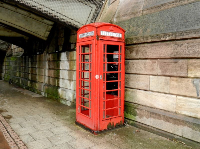
Entry Name: K6 Telephone Kiosk Adjacent to Handyside Bridge
Listing Date: 4 September 1987
Grade: II
Source: Historic England
Source ID: 1230232
English Heritage Legacy ID: 405125
ID on this website: 101230232
Location: Derby, Derbyshire, DE1
County: City of Derby
Electoral Ward/Division: Darley
Parish: Non Civil Parish
Built-Up Area: Derby
Traditional County: Derbyshire
Lieutenancy Area (Ceremonial County): Derbyshire
Church of England Parish: Derby St John the Evangelist
Church of England Diocese: Derby
Tagged with: K6 telephone box
FRIAR GATE 1. 5170 SK 3436 SE K6 telephone kiosk 4/13B adjacent to Handyside Bridge GV II 2. Telephone kiosk. Type K6. Designed 1935 by Sir Giles Gilbert Scott. Made by various contractors. Cast iron. Square kiosk with domed roof. Unperforated crowns to top panels and margin glazing to windows and door.
Listing NGR: SK3467036406
External links are from the relevant listing authority and, where applicable, Wikidata. Wikidata IDs may be related buildings as well as this specific building. If you want to add or update a link, you will need to do so by editing the Wikidata entry.


Other nearby listed buildings