Latitude: 54.7423 / 54°44'32"N
Longitude: -2.1996 / 2°11'58"W
OS Eastings: 387244
OS Northings: 538609
OS Grid: NY872386
Mapcode National: GBR FF2L.LT
Mapcode Global: WHB3H.52TB
Plus Code: 9C6VPRR2+W4
Entry Name: Coronation Bridge over River Wear
Listing Date: 5 June 1987
Grade: II
Source: Historic England
Source ID: 1230037
English Heritage Legacy ID: 404871
ID on this website: 101230037
Location: West Blackdene, County Durham, DL13
County: County Durham
Civil Parish: Stanhope
Traditional County: Durham
Lieutenancy Area (Ceremonial County): County Durham
Church of England Parish: St John's Chapel
Church of England Diocese: Durham
Tagged with: Bridge
STANHOPE A689 (North side,off) NY 83 NE Newhouse 36/119 Coronation Bridge over River Wear
GV II
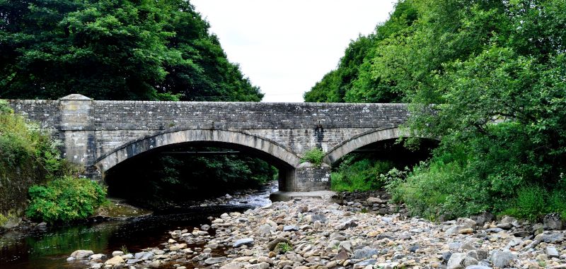
Bridge. 1840. Coursed squared sandstone with ashlar dressings. 2 wide recessed segmental arches, with voussoirs and drip bands, band under road-bed level; central cutwaters. Flanking wide ashlar pilasters continuing to form rectangular-plan piers with hipped coping, which terminate round-coped parapets.
Listing NGR: NY8724438609
External links are from the relevant listing authority and, where applicable, Wikidata. Wikidata IDs may be related buildings as well as this specific building. If you want to add or update a link, you will need to do so by editing the Wikidata entry.


Other nearby listed buildings