Latitude: 52.6641 / 52°39'50"N
Longitude: 0.1527 / 0°9'9"E
OS Eastings: 545677
OS Northings: 309553
OS Grid: TF456095
Mapcode National: GBR L1Q.WZQ
Mapcode Global: WHJPH.99YG
Plus Code: 9F42M573+J3
Entry Name: 39 and 40, North Brink
Listing Date: 10 February 1969
Grade: II
Source: Historic England
Source ID: 1229461
English Heritage Legacy ID: 48377
ID on this website: 101229461
Location: Wisbech, Fenland, Cambridgeshire, PE13
County: Cambridgeshire
District: Fenland
Civil Parish: Wisbech
Built-Up Area: Wisbech
Traditional County: Cambridgeshire
Lieutenancy Area (Ceremonial County): Cambridgeshire
Church of England Parish: Wisbech St Peter and St Paul
Church of England Diocese: Ely
Tagged with: Building
The following previous listing date shall be added.
Page 77 Item number 5/178 10.2.69
-------------------------------------
WISBECH NORTH BRINK TF 4509 5/178 Nos. 39 and 40 GV II
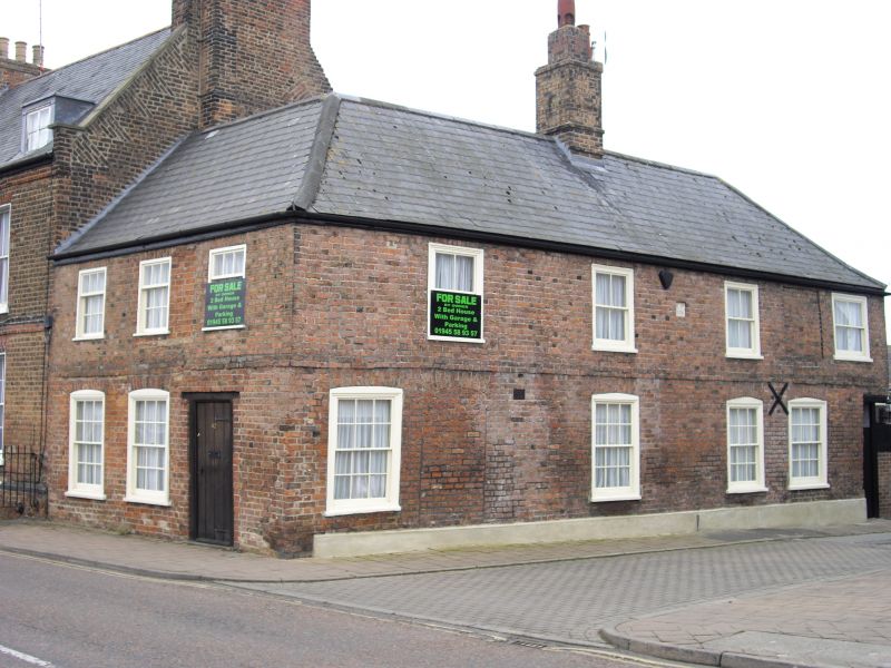
House, originally two cottages dated 'C.P. 1774' on stone plaque. Local brown brick; hipped slate roof with ridge stack. Two storeys, L-plan. Band between floors. River facade has three first floor hung sash windows with glazing bars in flush frames and two ground-floor windows. Plain wooden architraved doorcase and modern six-panelled door. Side elevation has four hung sash windows at both floor levels in segmental arches and one blocked doorway. Photographs and prints, C18 and C19, W. & F. Mus.
Listing NGR: TF4567709553
External links are from the relevant listing authority and, where applicable, Wikidata. Wikidata IDs may be related buildings as well as this specific building. If you want to add or update a link, you will need to do so by editing the Wikidata entry.


Other nearby listed buildings