Latitude: 53.8718 / 53°52'18"N
Longitude: -1.446 / 1°26'45"W
OS Eastings: 436522
OS Northings: 441876
OS Grid: SE365418
Mapcode National: GBR LRBN.QT
Mapcode Global: WHDB5.RYM5
Plus Code: 9C5WVHC3+PH
Entry Name: Scarcroft Toll Bar at Junction with Wetherby Road
Listing Date: 2 September 1985
Grade: II
Source: Historic England
Source ID: 1227579
English Heritage Legacy ID: 425464
ID on this website: 101227579
Location: Scarcroft, Leeds, West Yorkshire, LS14
County: Leeds
Civil Parish: Scarcroft
Built-Up Area: Scarcroft
Traditional County: Yorkshire
Lieutenancy Area (Ceremonial County): West Yorkshire
Church of England Parish: Thorner St Peter
Church of England Diocese: Leeds
Tagged with: Architectural structure
SCARCROFT THORNER LANE SE34SE LS14 (north side) SE365418
7/166 Scarcroft Toll Bar at junction with Wetherby Road 2.9.85
- II
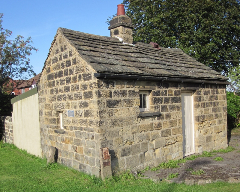
Toll-bar house, unoccupied. Early-mid C19. Hammer-dressed stone, stone slate roof. Single storey. 2 cells with direct-entry into 2nd cell. Doorway has monolithic lintel and 6-panel door with raised-and-fielded panels. To left a small window with lintel and projecting sill. Ridge stack at junction of the 2 cells. Right-hand return has window with lintel and projecting sill with deep chamfer retaining 4-pane sash. Left-hand return has small opening with ventilated board, probably a coal-shute.
A toll bar on the former Collingham Turnpike c1826, part of the Leeds-Wetherby Turnpike. That the building existed in 1841 is proved by the Census for that year which mentions "Marmaduke Dickinson, 65. Toll collector at Scarcroft Bar".
Listing NGR: SE3652241876
External links are from the relevant listing authority and, where applicable, Wikidata. Wikidata IDs may be related buildings as well as this specific building. If you want to add or update a link, you will need to do so by editing the Wikidata entry.


Other nearby listed buildings