Latitude: 53.0536 / 53°3'12"N
Longitude: -1.2044 / 1°12'15"W
OS Eastings: 453423
OS Northings: 351000
OS Grid: SK534510
Mapcode National: GBR 8GB.GBV
Mapcode Global: WHDGC.GHPW
Plus Code: 9C5W3Q3W+C6
Entry Name: Top Cross
Listing Date: 13 October 1966
Grade: II
Source: Historic England
Source ID: 1227505
English Heritage Legacy ID: 425334
ID on this website: 101227505
Location: Linby, Gedling, Nottinghamshire, NG15
County: Nottinghamshire
District: Gedling
Civil Parish: Linby
Built-Up Area: Hucknall
Traditional County: Nottinghamshire
Lieutenancy Area (Ceremonial County): Nottinghamshire
Church of England Parish: Linby with Papplewick
Church of England Diocese: Southwell and Nottingham
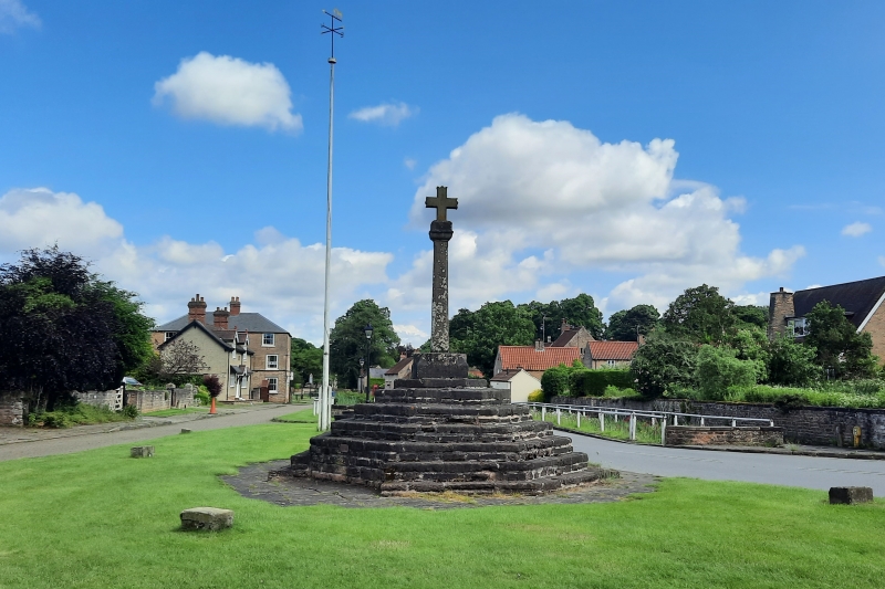
LINBY MAIN STREET SK 55 SW (north side) 1/84 Top Cross 13.10.66 G.V. II Village cross. C14, restored 1869. Dressed stone. Octagonal base of 7 steps. Broached square plinth. Chamfered tapered square cross with cornice. Head restored 1869.
Listing NGR: SK5342351000


Other nearby listed buildings