Latitude: 50.9315 / 50°55'53"N
Longitude: -0.6077 / 0°36'27"W
OS Eastings: 497940
OS Northings: 115592
OS Grid: SU979155
Mapcode National: GBR FH5.H68
Mapcode Global: FRA 96MN.12P
Plus Code: 9C2XW9JR+HW
Entry Name: Rock Cottage
Listing Date: 22 February 1984
Last Amended: 22 May 1985
Grade: II
Source: Historic England
Source ID: 1227120
English Heritage Legacy ID: 424740
ID on this website: 101227120
Location: Sutton, Chichester, West Sussex, RH20
County: West Sussex
District: Chichester
Civil Parish: Sutton
Built-Up Area: Sutton
Traditional County: Sussex
Lieutenancy Area (Ceremonial County): West Sussex
Church of England Parish: Sutton St John the Baptist with Bignor Holy Cross
Church of England Diocese: Chichester
Tagged with: Cottage
SU 9715 SUTTON THE STREET (east side)
24/86 Rock Cottage (Formerly 22.2.84 listed as Rock Cottages) II
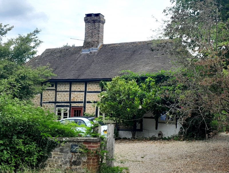
Once two cottages, now one house. C17 or earlier timber-framed building with stone rubble infilling, now painted. Hipped tiled roof. Casement windows. Two storeys. Three windows.
Listing NGR: SU9794015592
External links are from the relevant listing authority and, where applicable, Wikidata. Wikidata IDs may be related buildings as well as this specific building. If you want to add or update a link, you will need to do so by editing the Wikidata entry.


Other nearby listed buildings