Latitude: 53.9127 / 53°54'45"N
Longitude: -1.4099 / 1°24'35"W
OS Eastings: 438861
OS Northings: 446444
OS Grid: SE388464
Mapcode National: GBR LRL6.K4
Mapcode Global: WHDB0.9XWB
Plus Code: 9C5WWH7R+33
Entry Name: Linton Bridge
Listing Date: 22 July 1986
Grade: II
Source: Historic England
Source ID: 1225848
English Heritage Legacy ID: 422841
ID on this website: 101225848
Location: Linton, Leeds, West Yorkshire, LS22
County: Leeds
Civil Parish: Collingham
Built-Up Area: Wetherby
Traditional County: Yorkshire
Lieutenancy Area (Ceremonial County): West Yorkshire
Church of England Parish: Wetherby St James
Church of England Diocese: Leeds
Tagged with: Bridge
COLLINGHAM LINTON ROAD SE34NE LS22 SE388464
3/45 Linton Bridge
II
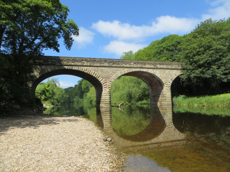
Road-bridge over the River wharf. Early-mid C19, the parapet renewed perhaps late C19. Rock-faced stone, brick to intrados of arches. 3 basket arches with rusticated voussoirs aligned to the courses. Rounded cut-waters. Ashlar band. Rock-faced parapet terminating in square piers.
Listing NGR: SE3886146444
External links are from the relevant listing authority and, where applicable, Wikidata. Wikidata IDs may be related buildings as well as this specific building. If you want to add or update a link, you will need to do so by editing the Wikidata entry.


Other nearby listed buildings