Latitude: 51.8081 / 51°48'29"N
Longitude: -1.639 / 1°38'20"W
OS Eastings: 424982
OS Northings: 212225
OS Grid: SP249122
Mapcode National: GBR 5SW.LF7
Mapcode Global: VHBZS.JTV8
Plus Code: 9C3WR956+69
Entry Name: The Malthouse
Listing Date: 12 September 1955
Grade: II
Source: Historic England
Source ID: 1225266
English Heritage Legacy ID: 421558
ID on this website: 101225266
Location: Burford, West Oxfordshire, OX18
County: Oxfordshire
District: West Oxfordshire
Civil Parish: Burford
Built-Up Area: Burford
Traditional County: Oxfordshire
Lieutenancy Area (Ceremonial County): Oxfordshire
Church of England Parish: Burford
Church of England Diocese: Oxford
Tagged with: Architectural structure
BURFORD AND UPTON SHEEP STREET AND SIGNET (North side) SP2412-2512 The Malthouse 5/195 12.9.55
GV II
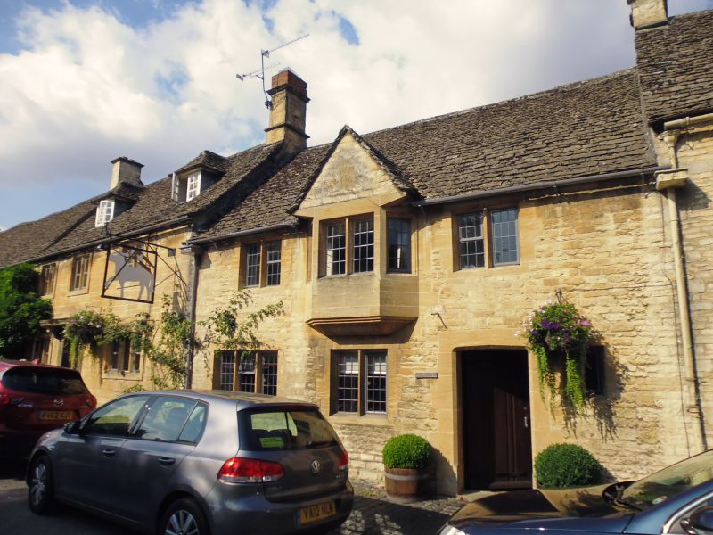
House, 1946 rebuilding. Coursed rubble with ashlar dressings, Cotswold stone roof. Ashlar off-ridge chimney 2 storeys; 3 windows, 2- and 3-light mullion windows. The central 1st floor window is a 1:2:1 oriel on moulded corbel with gable and datestone (N.G. 1946). Tudor arch doorway to right of centre with plank door.
Listing NGR: SP2498212225
External links are from the relevant listing authority and, where applicable, Wikidata. Wikidata IDs may be related buildings as well as this specific building. If you want to add or update a link, you will need to do so by editing the Wikidata entry.


Other nearby listed buildings