Latitude: 51.3378 / 51°20'16"N
Longitude: 1.286 / 1°17'9"E
OS Eastings: 628971
OS Northings: 164982
OS Grid: TR289649
Mapcode National: GBR VZ3.1XW
Mapcode Global: VHLGC.7MPT
Plus Code: 9F3387QP+49
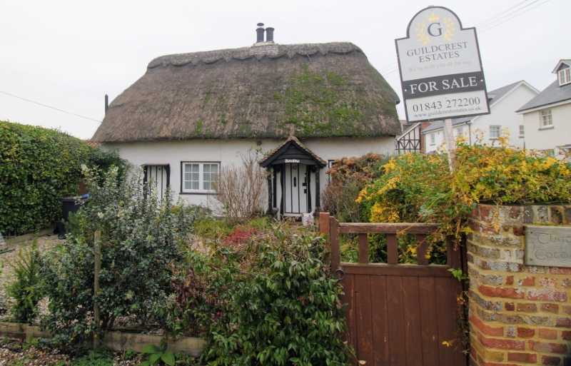
Entry Name: Thatch Cottage
Listing Date: 7 October 1986
Grade: II
Source: Historic England
Source ID: 1224772
English Heritage Legacy ID: 420396
ID on this website: 101224772
Location: Monkton, Thanet, Kent, CT12
County: Kent
District: Thanet
Civil Parish: Monkton
Built-Up Area: Monkton
Traditional County: Kent
Lieutenancy Area (Ceremonial County): Kent
Tagged with: Cottage Thatched cottage
MONKTON MONKTON STREET TR 26 SE (South side) 3/63 No. 62 Thatch Cottage II House. C17. Rendered with thatched roof. One storey and garret. Half-hipped roof with central stack. Two wooden casements and boarded door to left with flat hood and to right in gabled porch. One wooden casement with shutters on each floor to right return (road front).
Listing NGR: TR2897164979
External links are from the relevant listing authority and, where applicable, Wikidata. Wikidata IDs may be related buildings as well as this specific building. If you want to add or update a link, you will need to do so by editing the Wikidata entry.


Other nearby listed buildings