Latitude: 51.8068 / 51°48'24"N
Longitude: -1.6374 / 1°38'14"W
OS Eastings: 425099
OS Northings: 212076
OS Grid: SP250120
Mapcode National: GBR 5SW.LVW
Mapcode Global: VHBZS.KVR9
Plus Code: 9C3WR947+P3
Entry Name: 152 High Street
Listing Date: 12 September 1955
Last Amended: 1 March 1990
Grade: II
Source: Historic England
Source ID: 1224692
English Heritage Legacy ID: 420671
ID on this website: 101224692
Location: Burford, West Oxfordshire, OX18
County: Oxfordshire
District: West Oxfordshire
Civil Parish: Burford
Built-Up Area: Burford
Traditional County: Oxfordshire
Lieutenancy Area (Ceremonial County): Oxfordshire
Church of England Parish: Burford
Church of England Diocese: Oxford
Tagged with: Inn
This list entry was subject to a Minor Amendment on 5 July 2024 to amend the name, address and reformat the text to current standards
SP2512 (Enlargement)
7/154
BURFORD AND UPTON AND SIGNET
HIGH STREET (West side)
No 152
(Formerly listed as No 152 (The Dragon Inn) (previously listed as the New Inn).)
12.9.55
GV
II
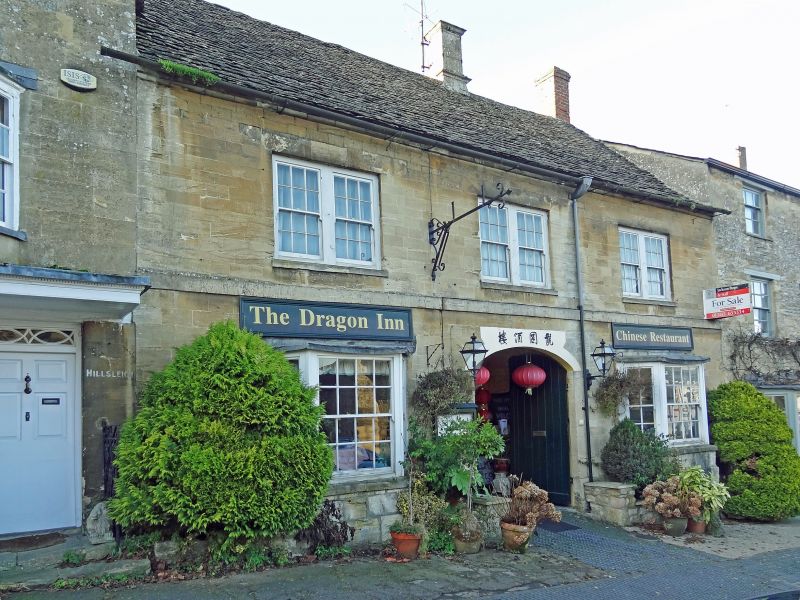
Former Burgage house, an inn for over 200 years. Early-mid C19 front in C18 style masking C17 remodelling of mediaeval building. Freestone with Cotswold stone roof. Coach-way between two wings, south wing appears to have been the storeyed wing off the hall (the rear wing). Two chimneys, ashlar with moulded capping to right of centre, brick to right. Two storeys; band over ground floor, oversailing eaves courses. Three windows on first floor, paired glazing-bar sashes; two outer angled bays on stone bases to ground floor and central segmental head entry. Two irregular two-storey extensions to rear, the south side one heavily beamed with reused presumably mediaeval timbers (thought to be site of earlier hall - if so an unusual plan). Inside the coachway is a beam with evidence of stud partition to left, into it the spine beam from the south room is tenoned plain ogee stop chamfer, cobbled coachway.
Listing NGR: SP2509912076
External links are from the relevant listing authority and, where applicable, Wikidata. Wikidata IDs may be related buildings as well as this specific building. If you want to add or update a link, you will need to do so by editing the Wikidata entry.


Other nearby listed buildings