Latitude: 51.3401 / 51°20'24"N
Longitude: 1.2778 / 1°16'40"E
OS Eastings: 628390
OS Northings: 165217
OS Grid: TR283652
Mapcode National: GBR VYW.ZVM
Mapcode Global: VHLGC.3LC0
Plus Code: 9F3387RH+34
Entry Name: The Vicarage
Listing Date: 5 December 1973
Grade: II
Source: Historic England
Source ID: 1224342
English Heritage Legacy ID: 420392
ID on this website: 101224342
Location: Monkton, Thanet, Kent, CT12
County: Kent
District: Thanet
Civil Parish: Monkton
Built-Up Area: Monkton
Traditional County: Kent
Lieutenancy Area (Ceremonial County): Kent
Tagged with: Clergy house
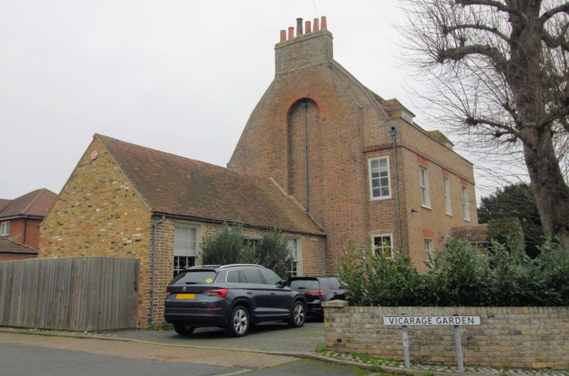
MONKTON MONKTON STREET TR 26 NE (north side) 1/59 The Vicarage 5.12.73 GV II House. Early C19. Brown brick and plain tiled roof. Two storeys and attic with brick cornice to parapet. Gambrel roof with 2 hipped dormers and stack projecting at end left. Regular fenestration of 3 glazing bar sashes with gauged heads on first floor and 2 on ground floor, and central gabled porch with blank panel, and boarded door on left side. Single storey extension to left, with garage doors, and segmental headed recess with boarded door and rectangular fanlight.
Listing NGR: TR2845965170
External links are from the relevant listing authority and, where applicable, Wikidata. Wikidata IDs may be related buildings as well as this specific building. If you want to add or update a link, you will need to do so by editing the Wikidata entry.


Other nearby listed buildings