Latitude: 51.3309 / 51°19'51"N
Longitude: 1.319 / 1°19'8"E
OS Eastings: 631304
OS Northings: 164324
OS Grid: TR313643
Mapcode National: GBR X0G.J9D
Mapcode Global: VHLGC.TT42
Plus Code: 9F3388J9+9H
Entry Name: Durlock Lodge
Listing Date: 7 October 1986
Grade: II
Source: Historic England
Source ID: 1223818
English Heritage Legacy ID: 419690
ID on this website: 101223818
Location: Durlock, Thanet, Kent, CT12
County: Kent
District: Thanet
Civil Parish: Minster
Built-Up Area: Minster (Thanet)
Traditional County: Kent
Lieutenancy Area (Ceremonial County): Kent
Tagged with: Gatehouse
MINSTER DURLOCK TR 3064-3164 (South Side) 5/25 Durlock Lodge
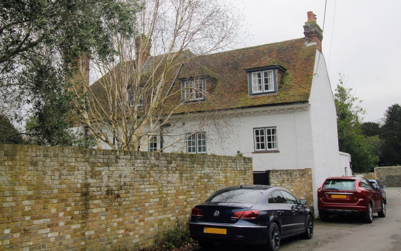
GV II House. Cl8 extended C19. Red brick and plain tiled roof. Irregular plan. Entrance front: 2 storeys, with projecting wings to left and right, with single storey extension left. Modillion eaves cornice to hipped roofs, with stacks to left, centre and right. Irregular fenestration of glazing bar sashes. Central door of 2 panels in moulded surround in recessed area. Return and rear elevations: with modillion eaves cornice, hipped roofs and dormers and glazing bar sashes throughout.
Listing NGR: TR3130964328
External links are from the relevant listing authority and, where applicable, Wikidata. Wikidata IDs may be related buildings as well as this specific building. If you want to add or update a link, you will need to do so by editing the Wikidata entry.


Other nearby listed buildings