Latitude: 50.7136 / 50°42'48"N
Longitude: -1.9872 / 1°59'14"W
OS Eastings: 400997
OS Northings: 90438
OS Grid: SZ009904
Mapcode National: GBR XQB.MR
Mapcode Global: FRA 67Q6.3MP
Plus Code: 9C2WP277+C4
Entry Name: 32, High Street
Listing Date: 14 June 1954
Grade: II
Source: Historic England
Source ID: 1223539
English Heritage Legacy ID: 412487
ID on this website: 101223539
Location: Old Town, Bournemouth, Christchurch and Poole, Dorset, BH15
County: Bournemouth, Christchurch and Poole
Parish: Poole
Built-Up Area: Poole
Traditional County: Dorset
Lieutenancy Area (Ceremonial County): Dorset
Church of England Parish: Poole St James with St Paul
Church of England Diocese: Salisbury
Tagged with: Building
POOLE
SZ0090SE HIGH STREET 958-1/17/42 (North West side) 14/06/54 No.32
GV II
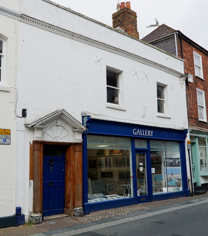
House. Late C16-early C17, refronted C18, altered. Roughcast with brick gable stacks and a tiled roof. 2 storeys; 2-window range. Parapeted front with moulded cornice, a good left-hand mid C18 timber doorcase has attached columns on stone plinths, entablature blocks and open pediment to a 6-panel door with glazed top panels keyed, painted radial fanlight; to the right a mid C20 shop front with fascia and plate-glass windows, and 2 first-floor plate-glass sashes. Rear wall reported to contain C17 chamfered stone jambs and part of a chamfered stone mullion window with moulded label and square stop on the SW wall. INTERIOR: ground-floor opened to form shop. HISTORICAL NOTE: roof carries over to No.30 (qv), with which it was probably originally one. (RCHME: County of Dorset (South East): London: 1970-: 223).
Listing NGR: SZ0099790438
External links are from the relevant listing authority and, where applicable, Wikidata. Wikidata IDs may be related buildings as well as this specific building. If you want to add or update a link, you will need to do so by editing the Wikidata entry.


Other nearby listed buildings