Latitude: 52.5089 / 52°30'31"N
Longitude: -0.3226 / 0°19'21"W
OS Eastings: 513938
OS Northings: 291430
OS Grid: TL139914
Mapcode National: GBR GZ1.P89
Mapcode Global: VHGL1.C69J
Plus Code: 9C4XGM5G+GX
Entry Name: Manor Farmhouse
Listing Date: 16 November 1988
Grade: II
Source: Historic England
Source ID: 1222031
English Heritage Legacy ID: 414064
ID on this website: 101222031
Location: Morborne, Huntingdonshire, Cambridgeshire, PE7
County: Cambridgeshire
District: Huntingdonshire
Civil Parish: Morborne
Traditional County: Huntingdonshire
Lieutenancy Area (Ceremonial County): Cambridgeshire
Church of England Parish: Morborne All Saints
Church of England Diocese: Ely
Tagged with: Farmhouse
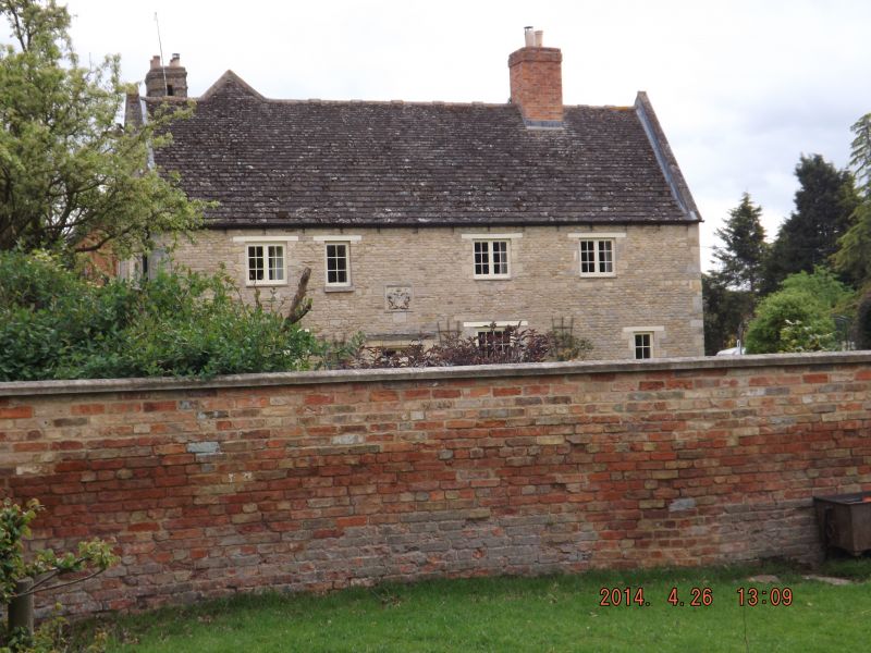
MORBORNE MORBORNE TL 1291 19/96 Manor Farmhouse II Farmhouse. Dated 1692 on stone above door. Mid to late C19 extension and alterations. Coursed rubble limestone and Ketton stone dressings. C19 red brick. Collyweston stone slate roofs with parapet gables. Red brick ridge stack, and rear stack. Two storeys with attics; L-plan with original three-unit planned range facing north-west. Original doorway to left of centre with moulded and stopped jambs, formerly with a four-centred head cut later to a flat arch, with a moulded cornice. Plain dated stone above doorway and panel with carved achievement of quartered arms of the Forrests of Morborne with initials A.F. and later incised initials M.G.W. Windows all with wooden lintels, two ground floor casement windows and one twelve-paned hung sash window, two first floor iron framed casement windows and one blocked window to right hand. C19 side entrance in open brick porch. Interior plan altered with inserted C19 staircase. Stone chimney piece in south-west first floor room with similar details to doorway. Ogee-moulded and stop-chamfered ceiling beams. C19 flower-arranging sink in hallway. The manor farmhouse is one of three surviving buildings of the original village outlined clearly on aerial photographs.
RCHM Huntingdonshire p186 VCH Huntingdonshire p188 Aerial Photography Dept Cambs University.
Listing NGR: TL1393891430
External links are from the relevant listing authority and, where applicable, Wikidata. Wikidata IDs may be related buildings as well as this specific building. If you want to add or update a link, you will need to do so by editing the Wikidata entry.


Other nearby listed buildings