Latitude: 52.5923 / 52°35'32"N
Longitude: -2.3409 / 2°20'27"W
OS Eastings: 377006
OS Northings: 299447
OS Grid: SO770994
Mapcode National: GBR 07T.H0D
Mapcode Global: WH9DR.03LG
Plus Code: 9C4VHMR5+WM
Entry Name: Hunter's Bridge
Listing Date: 26 September 1984
Grade: II
Source: Historic England
Source ID: 1221918
English Heritage Legacy ID: 255147
ID on this website: 101221918
Location: Badger, Shropshire, WV6
County: Shropshire
Civil Parish: Badger
Traditional County: Shropshire
Lieutenancy Area (Ceremonial County): Shropshire
Church of England Parish: Badger St Giles
Church of England Diocese: Lichfield
Tagged with: Bridge
SO 79 NE BADGER C.P. BADGER
7/58 Hunter's Bridge
-
G.V. II
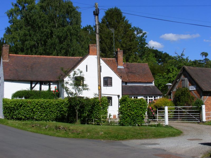
House. C17 with later additions and alterations. Timber framed on brick plinth with,painted brick infilling, plain tiled roof, brick end stacks. Originally of 3 structural bays with C19 brick extensions to left and right. Square panelling with short tension braces; irregular fenestration, C20 casements and 3 C20 gabled eaves dormers, entrances through C20 doors to left and right of centre. Interior retains some structural timber framing.
Listing NGR: SO7700699447
External links are from the relevant listing authority and, where applicable, Wikidata. Wikidata IDs may be related buildings as well as this specific building. If you want to add or update a link, you will need to do so by editing the Wikidata entry.


Other nearby listed buildings