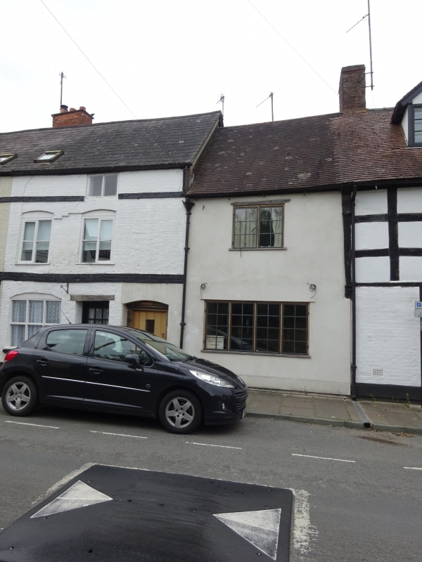
Latitude: 52.3735 / 52°22'24"N
Longitude: -2.72 / 2°43'12"W
OS Eastings: 351077
OS Northings: 275299
OS Grid: SO510752
Mapcode National: GBR BK.RR13
Mapcode Global: VH843.SLWT
Plus Code: 9C4V97FH+CX
Entry Name: Corve Cottage
Listing Date: 15 March 1974
Grade: II
Source: Historic England
Source ID: 1221079
English Heritage Legacy ID: 389879
ID on this website: 101221079
Location: Ludlow, Shropshire, SY8
County: Shropshire
Civil Parish: Ludlow
Built-Up Area: Ludlow
Traditional County: Shropshire
Lieutenancy Area (Ceremonial County): Shropshire
Church of England Parish: Ludlow St Laurence
Church of England Diocese: Hereford
Tagged with: Cottage
LUDLOW
SO5175 CORVE STREET 825-1/2/253 (West side) 15/03/74 No.70A Corve Cottage
GV II
House. C19 front to probably C17 core. Painted brick; plain tile roof; brick stack to rear. 2-storeys; 1-window range: C20 casement under timber lintel; plank door to left, with ornamental wrought-iron hinges and studs in plain case under oak lintel.
Listing NGR: SO5108075301
External links are from the relevant listing authority and, where applicable, Wikidata. Wikidata IDs may be related buildings as well as this specific building. If you want to add or update a link, you will need to do so by editing the Wikidata entry.


Other nearby listed buildings