Latitude: 50.7055 / 50°42'19"N
Longitude: -1.4995 / 1°29'58"W
OS Eastings: 435437
OS Northings: 89662
OS Grid: SZ354896
Mapcode National: GBR 78Q.RPD
Mapcode Global: FRA 77R6.TXL
Plus Code: 9C2WPG42+65
Entry Name: The Old House
Listing Date: 18 January 1967
Grade: II
Source: Historic England
Source ID: 1221056
English Heritage Legacy ID: 393286
ID on this website: 101221056
Location: Yarmouth, Isle of Wight, PO41
County: Isle of Wight
Civil Parish: Yarmouth
Built-Up Area: Yarmouth
Traditional County: Hampshire
Lieutenancy Area (Ceremonial County): Isle of Wight
Church of England Parish: Yarmouth St James
Church of England Diocese: Portsmouth
Tagged with: House
YARMOUTH
SZ3589 ST JAMES'S STREET 1354-0/10/394 (West side) 18/01/67 The Old House
GV II
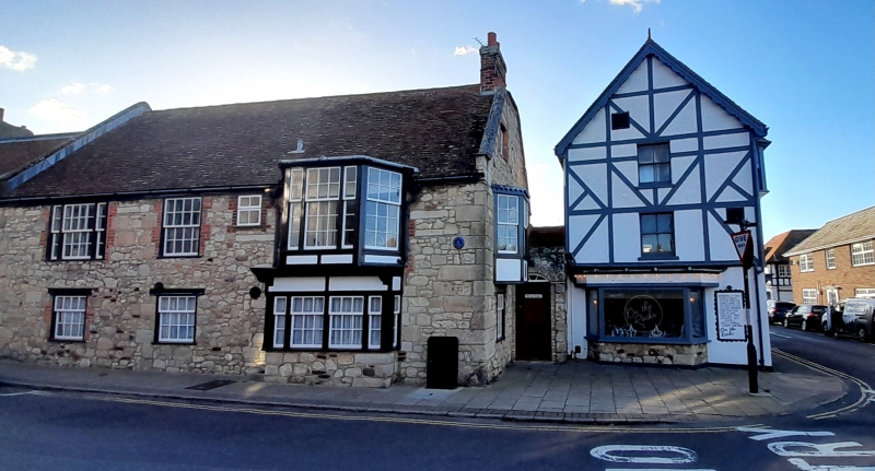
House. Datestone P.C. 1625 on front elevation altered early to mid C19. Built of Isle of Wight stone rubble with ashlar quoins and some red brick dressings. Tiled roof with end brick stacks, gable ends with stone coping and kneelers. 2 storeys and attics 4 windows. 1st floor has 1 tripartite early C19 sash, 1 early C19 16-pane sash, small C20 window and C19 2 storey bay to right hand side. Ground floor has 2 12-paned bays to 1st floor and 9 paned sash to ground floor. Doorcase is in stone extension and is early C19 with cambered surround with fanlight, impost blocks and C20 plank doors. Small 3-light round-headed window in side. Interior has early C17 stone fireplace with stone lintel and carved sides. 1 spine beam has lambs tongue stop and 3 grooves and another is roll moulded. 1st floor has 2 inch chamfered axial beam with lambs tongue stop. Attic has early C18 2 panelled door and roof with principal rafters.
Listing NGR: SZ3543789662
External links are from the relevant listing authority and, where applicable, Wikidata. Wikidata IDs may be related buildings as well as this specific building. If you want to add or update a link, you will need to do so by editing the Wikidata entry.


Other nearby listed buildings