Latitude: 53.0118 / 53°0'42"N
Longitude: -2.2294 / 2°13'45"W
OS Eastings: 384707
OS Northings: 346074
OS Grid: SJ847460
Mapcode National: GBR M7G.0W
Mapcode Global: WHBCS.QKLG
Plus Code: 9C5V2Q6C+P7
Entry Name: Chest Tomb in Church Yard Circa 10 Metres North of Church
Listing Date: 23 December 1991
Grade: II
Source: Historic England
Source ID: 1219557
English Heritage Legacy ID: 385915
ID on this website: 101219557
Location: St Giles' Church, Newcastle-under-Lyme, Staffordshire, ST5
County: Staffordshire
District: Newcastle-under-Lyme
Electoral Ward/Division: Town
Parish: Non Civil Parish
Built-Up Area: Newcastle-under-Lyme
Traditional County: Staffordshire
Lieutenancy Area (Ceremonial County): Staffordshire
Church of England Parish: Newcastle-under-LymeStGiles
Church of England Diocese: Lichfield
Tagged with: Chest tomb
NEWCASTLE UNDER LYME
SJ8446SE CHURCH STREET 644-1/8/7 (North West side) Chest Tomb in Church yard c10m north of Church
GV II
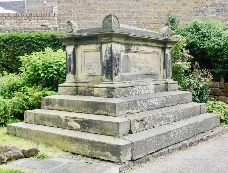
Chest tomb in memory of Samuel Mayer, died 1738. By W. Spence of Liverpool. Rectangular tomb with depressed pyramidal cap raised on steps. Lettering in the long sides, with carved emblems of the passion, justice, etc. in the pilasters which mark the angles. Crouching angels and wheatsheafs etc in the lugged angles of the cap.
Listing NGR: SJ8470746074
External links are from the relevant listing authority and, where applicable, Wikidata. Wikidata IDs may be related buildings as well as this specific building. If you want to add or update a link, you will need to do so by editing the Wikidata entry.


Other nearby listed buildings