Latitude: 51.9691 / 51°58'8"N
Longitude: -0.6883 / 0°41'17"W
OS Eastings: 490206
OS Northings: 230877
OS Grid: SP902308
Mapcode National: GBR F2H.DSV
Mapcode Global: VHFQX.0RZW
Plus Code: 9C3XX896+JM
Entry Name: Church Farmhouse
Listing Date: 6 July 1984
Grade: II
Source: Historic England
Source ID: 1219248
English Heritage Legacy ID: 350768
ID on this website: 101219248
Location: Green End, Buckinghamshire, MK17
County: Buckinghamshire
Civil Parish: Great Brickhill
Traditional County: Buckinghamshire
Lieutenancy Area (Ceremonial County): Buckinghamshire
Church of England Parish: Great Brickhill
Church of England Diocese: Oxford
Tagged with: Farmhouse
SP 9030 GREAT BRICKHILL LITTLE BRICKHILL ROAD
9/30 Church Farmhouse
II
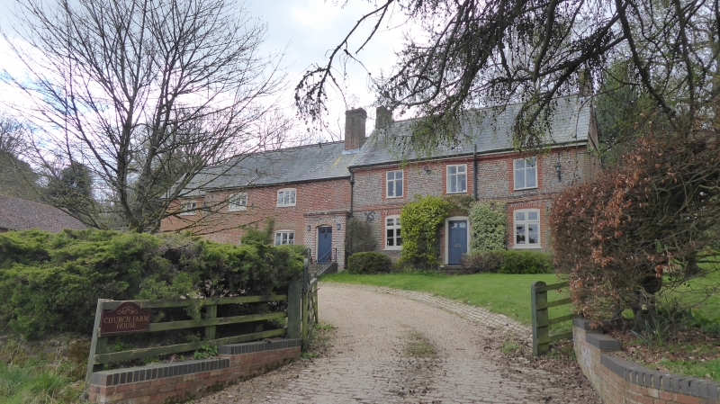
House Late C18 and early C19 remodelling of and extensions to older building 2 attached blocks. Right block is late C18 and is of vitreous header brick with red brick quoins and window surrounds, first floor band course, moulded brick eaves and rendered plinth Slate roof, of steeper pitch than usual, with flanking brick chimneys. 2 storeys, 3 bays. Cross casements with altered glazing, those to ground floor with cambered heads. Central C20 door with rebuilt segmental head. Block to left is of early C19 chequer brick with some slight timber framing to rear. Similar slate roof, C17 brick chimney with 'V' pilasters to right. 2 storeys, 2 bays C19 3-light wooden casements with segmental heads to first floor and ground floor right. Porch to right, in line with chimney, is of vitreous brick with red dressings and has flush-panelled door in segmental head. Ground floor left bay and adjacent lean-to are irregular.
Listing NGR: SP9020630877
External links are from the relevant listing authority and, where applicable, Wikidata. Wikidata IDs may be related buildings as well as this specific building. If you want to add or update a link, you will need to do so by editing the Wikidata entry.


Other nearby listed buildings