Latitude: 51.2947 / 51°17'41"N
Longitude: 0.411 / 0°24'39"E
OS Eastings: 568191
OS Northings: 157828
OS Grid: TQ681578
Mapcode National: GBR NPC.NQZ
Mapcode Global: VHJM5.2QLB
Plus Code: 9F327CV6+V9
Entry Name: Brook Cottage
Listing Date: 30 November 1993
Grade: II
Source: Historic England
Source ID: 1219030
English Heritage Legacy ID: 392434
ID on this website: 101219030
Location: West Malling, Tonbridge and Malling, Kent, ME19
County: Kent
District: Tonbridge and Malling
Civil Parish: West Malling
Built-Up Area: West Malling
Traditional County: Kent
Lieutenancy Area (Ceremonial County): Kent
Church of England Parish: West Malling St Mary
Church of England Diocese: Rochester
Tagged with: Cottage
WEST MALLING
TQ6857 POLICE STATION ROAD 1156-0/3/122 No.14 Brook Cottage
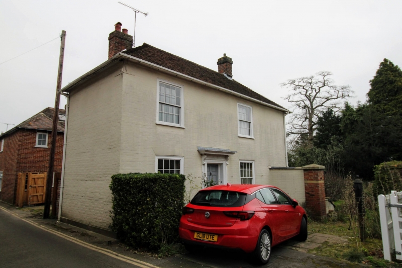
GV II Cottage. Early C19. Painted brick in Flemish bond. Hipped tiled roof with 2 brick chimneystacks. 2 storeys; 2 windows. 16-pane sashes with moulded architraves. Central doorcase with flat hood on brackets and 6-fielded panelled door. C20 splayed 2-storey extension to rear.
Listing NGR: TQ6819357826
External links are from the relevant listing authority and, where applicable, Wikidata. Wikidata IDs may be related buildings as well as this specific building. If you want to add or update a link, you will need to do so by editing the Wikidata entry.


Other nearby listed buildings