Latitude: 54.8937 / 54°53'37"N
Longitude: -2.929 / 2°55'44"W
OS Eastings: 340514
OS Northings: 555836
OS Grid: NY405558
Mapcode National: GBR 7CZV.PJ
Mapcode Global: WH802.Z8F7
Plus Code: 9C6VV3VC+FC
Entry Name: 71, Warwick Road
Listing Date: 11 April 1994
Grade: II
Source: Historic England
Source ID: 1218882
English Heritage Legacy ID: 386894
ID on this website: 101218882
Location: Carlisle, Cumberland, Cumbria, CA1
County: Cumberland
District: Carlisle
Parish: Non Civil Parish
Built-Up Area: Carlisle
Traditional County: Cumberland
Lieutenancy Area (Ceremonial County): Cumbria
Church of England Parish: Carlisle St Aidan
Church of England Diocese: Carlisle
Tagged with: Building
CARLISLE
NY4055 WARWICK ROAD 671-1/11/294 (North side) No.71
GV II
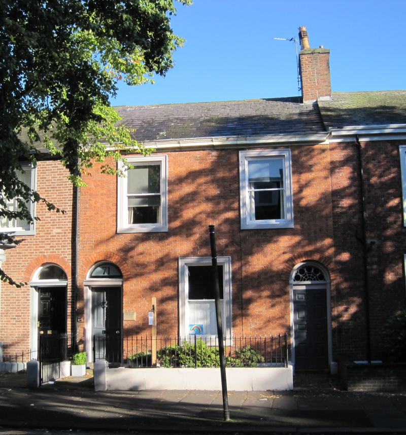
House forming part of a terrace. 1840s. Flemish bond brickwork on chamfered plinth and with stone cornice, all dressings of painted stone. Graduated Welsh slate roof; original shared ridge brick chimney stack. 2 storeys, 2 bays. Left panelled door and fanlight in stone surround within a rounded brick archway; similar right doorway for through-passage with a radial patterned fanlight. Sash windows in stone architraves. INTERIOR not inspected. This property is shown on the 1842 Studholme map of Carlisle.
Listing NGR: NY4051455836
External links are from the relevant listing authority and, where applicable, Wikidata. Wikidata IDs may be related buildings as well as this specific building. If you want to add or update a link, you will need to do so by editing the Wikidata entry.


Other nearby listed buildings