Latitude: 53.26 / 53°15'36"N
Longitude: -2.1244 / 2°7'27"W
OS Eastings: 391798
OS Northings: 373676
OS Grid: SJ917736
Mapcode National: GBR FZLR.W2
Mapcode Global: WHBBP.BBM4
Plus Code: 9C5V7V6G+26
Entry Name: 37 and 39, Churchside
Listing Date: 17 March 1977
Last Amended: 28 October 1994
Grade: II
Source: Historic England
Source ID: 1218651
English Heritage Legacy ID: 390964
ID on this website: 101218651
Location: Macclesfield, Cheshire East, Cheshire, SK10
County: Cheshire East
Civil Parish: Macclesfield
Built-Up Area: Macclesfield
Traditional County: Cheshire
Lieutenancy Area (Ceremonial County): Cheshire
Church of England Parish: St Michael and All Angels, Macclesfield
Church of England Diocese: Chester
Tagged with: Building Terrace house
MACCLESFIELD
SJ9173NE CHURCHSIDE 886-1/10/64 (South side) 17/03/77 Nos.37 AND 39 (Formerly Listed as: CHURCHSIDE (South side) Nos.31-43 (ODD) AND 47)
GV II
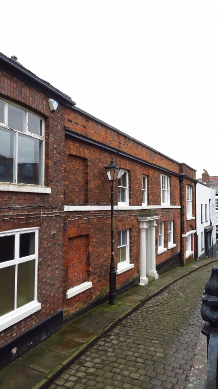
Pair of houses forming part of a longer row, one now in use as office. Early C19. Flemish-bond brickwork with Welsh slate roof. 2 storeys, 3-window range, each a single unit, double-pile plan with doorway to the right. 6-panelled doors in round-arched reeded architrave with plain fanlights. 4-pane sash windows throughout, with flat-arched gauged brick heads. Blind window over left hand doorway. Doorway to passage on right. End wall stacks.
Listing NGR: SJ9180173674
External links are from the relevant listing authority and, where applicable, Wikidata. Wikidata IDs may be related buildings as well as this specific building. If you want to add or update a link, you will need to do so by editing the Wikidata entry.


Other nearby listed buildings