Latitude: 52.6795 / 52°40'46"N
Longitude: -1.8268 / 1°49'36"W
OS Eastings: 411809
OS Northings: 309104
OS Grid: SK118091
Mapcode National: GBR 4DN.T54
Mapcode Global: WHCGN.XX96
Plus Code: 9C4WM5HF+R7
Entry Name: Railway Bridge
Listing Date: 6 March 1970
Last Amended: 17 June 1994
Grade: II
Source: Historic England
Source ID: 1218273
English Heritage Legacy ID: 382733
ID on this website: 101218273
Location: Lichfield, Staffordshire, WS14
County: Staffordshire
District: Lichfield
Civil Parish: Lichfield
Built-Up Area: Lichfield
Traditional County: Staffordshire
Lieutenancy Area (Ceremonial County): Staffordshire
Church of England Parish: Lichfield St Michael and St Mary
Church of England Diocese: Lichfield
Tagged with: Railway bridge
LICHFIELD
SK1109SE ST JOHN STREET 1094-1/8/170 Railway Bridge 06/03/70 (Formerly Listed as: UPPER ST JOHN STREET Railway Bridge Abutments)
GV II
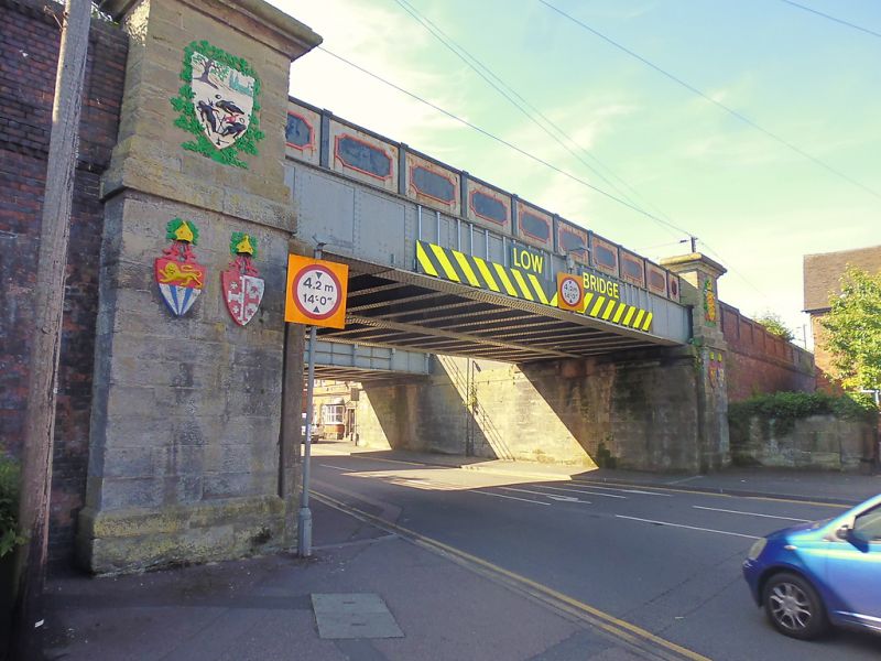
Railway bridge. 1849, altered 1882 and 1969. By Edward Adams (Clayton) or Thomas Johnson of Lichfield (V C H). For South Staffordshire Railway. Ashlar and cast-iron. Large ashlar abutments have plain plinths and top friezes with tall parapets with cornices. Each has to north 2 relief armorial bearings below frieze and one large one to parapet; the lower shields with arms of Bishops of Lichfield: Hackett, de Clinton, Lonsdale and Hayworth, the upper shields with the old Borough seal and the leopards of England (originally placed in the centre of the parapet, north and south). To south are 4 armorial bearings of local families: Anson, Forster, Dyott and Bagot. The 2 spans date from 1882, riveted iron plates; the parapets have rectangular panels with concave corners. Arcades covering pavements removed in 1969. (Howard Clayton: Cathedral City: Lichfield: 1977-: P.45-7; Victoria History of the County of Stafford: Greenslade M W: Lichfield: Oxford: 1990-: P.128).
Listing NGR: SK1180909104
External links are from the relevant listing authority and, where applicable, Wikidata. Wikidata IDs may be related buildings as well as this specific building. If you want to add or update a link, you will need to do so by editing the Wikidata entry.


Other nearby listed buildings