Latitude: 50.7162 / 50°42'58"N
Longitude: -2.4393 / 2°26'21"W
OS Eastings: 369081
OS Northings: 90825
OS Grid: SY690908
Mapcode National: GBR PY.RFC4
Mapcode Global: FRA 57S5.TSB
Plus Code: 9C2VPH86+F7
Entry Name: 35, Glyde Path Road
Listing Date: 8 May 1975
Grade: II
Source: Historic England
Source ID: 1218269
English Heritage Legacy ID: 104291
ID on this website: 101218269
Location: Dorchester, Dorset, DT1
County: Dorset
Civil Parish: Dorchester
Built-Up Area: Dorchester
Traditional County: Dorset
Lieutenancy Area (Ceremonial County): Dorset
Church of England Parish: Dorchester and West Stafford
Church of England Diocese: Salisbury
Tagged with: Building
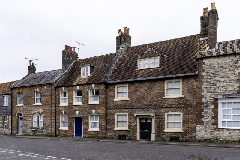
GLYDE PATH ROAD 1. 5191 (East Side) No 35 SY 6990 7/23 II GV 2. Cl8. 2 storeys and attics. Double-fronted brick house. String course. Brick dentil cornice to eaves. 1 4-light hipped dormer. Plaintile roof. Doorcase with moulded architrave and hood on shaped brackets. 2 ranges of cased sashes with segmental heads. Nos 31 to 35 (consec)and Nos 21 to 24 (consec) form a group with No 19 Colliton Street.
Listing NGR: SY6908190825
External links are from the relevant listing authority and, where applicable, Wikidata. Wikidata IDs may be related buildings as well as this specific building. If you want to add or update a link, you will need to do so by editing the Wikidata entry.


Other nearby listed buildings