Latitude: 51.4505 / 51°27'1"N
Longitude: -2.5961 / 2°35'45"W
OS Eastings: 358675
OS Northings: 172564
OS Grid: ST586725
Mapcode National: GBR C7L.TV
Mapcode Global: VH88M.YSFW
Plus Code: 9C3VFC23+6H
Entry Name: 55, Queen Square
Listing Date: 8 January 1959
Grade: II
Source: Historic England
Source ID: 1218086
English Heritage Legacy ID: 380260
ID on this website: 101218086
Location: Bristol, BS1
County: City of Bristol
Electoral Ward/Division: Central
Parish: Non Civil Parish
Built-Up Area: Bristol
Traditional County: Gloucestershire
Lieutenancy Area (Ceremonial County): Bristol
Church of England Parish: Bristol St Stephen with St James and St John the Baptist with St Michael and St George
Church of England Diocese: Bristol
Tagged with: Building
BRISTOL
ST5872NE QUEEN SQUARE 901-1/16/212 (West side) 08/01/59 No.55
GV II
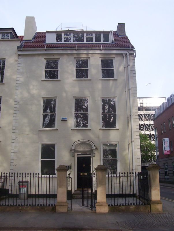
Attached house. Early C18. Stucco over brick with limestone dressings, gable stacks and a pantile roof. Double-depth plan. Early Georgian style. 3 storeys and attic; 3-window range. A near-symmetrical front has rusticated quoins to boxed eaves. Doorway with a good shell-hood on acanthus brackets and 4-panel door. Plate-glass sashes in exposed frames, and a wide C20 dormer. INTERIOR: central lateral dogleg winder stair, 2-panel doors with HL hinges, and fireplaces with eared surrounds. HISTORICAL NOTE: Queen Square was built between 1701 and 1727, to varied width leases and similar designs. No.55 survived the destruction of much of the W side in the 1831 Reform Bill riots. (Andor Gomme, Michael Jenner and Bryan Little: Bristol An architectural history: Bristol: 1979-: 95; Walter Ison: The Georgian Buildings of Bristol: Bath: 1952-: 140).
Listing NGR: ST5867572564
External links are from the relevant listing authority and, where applicable, Wikidata. Wikidata IDs may be related buildings as well as this specific building. If you want to add or update a link, you will need to do so by editing the Wikidata entry.


Other nearby listed buildings