Latitude: 51.5096 / 51°30'34"N
Longitude: -0.1261 / 0°7'33"W
OS Eastings: 530140
OS Northings: 180631
OS Grid: TQ301806
Mapcode National: GBR HF.V0
Mapcode Global: VHGQZ.RBP2
Plus Code: 9C3XGV5F+VH
Entry Name: 44, Chandos Place WC2
Listing Date: 15 January 1973
Grade: II
Source: Historic England
Source ID: 1217816
English Heritage Legacy ID: 209065
ID on this website: 101217816
Location: London, Westminster, London, WC2N
County: London
District: City of Westminster
Electoral Ward/Division: St James's
Parish: Non Civil Parish
Built-Up Area: City of Westminster
Traditional County: Middlesex
Lieutenancy Area (Ceremonial County): Greater London
Church of England Parish: St Martin-in-the-Fields
Church of England Diocese: London
Tagged with: Building
TQ 3080 NW CITY OF WESTMINSTER CHANDOS PLACE, WC2 72/122 15.1.73 No. 44
G.V. II
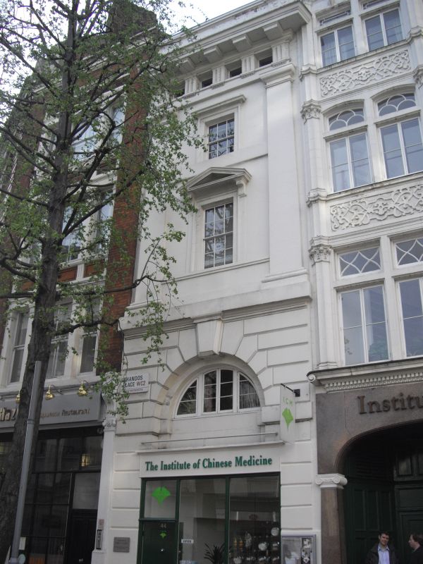
Terraced office or commercial premises. c.1830-40. Stucco, concealed roof. Unusually bold monumental neo classicism for a narrow frontage. 4 storeys and attic. One window wide. Ground and 1st floors rusticated with mid C.20 shop front to ground floor. A giant Doric pilaster order flanks the upper floors with semicircular arched lights to 1st floor bay window and architraved glazing bar sashes above, with cornice over to 2nd floor; the attic windows form the metopes of the frieze of the deep entablature surmounted by a parapet.
Listing NGR: TQ3013980635
External links are from the relevant listing authority and, where applicable, Wikidata. Wikidata IDs may be related buildings as well as this specific building. If you want to add or update a link, you will need to do so by editing the Wikidata entry.


Other nearby listed buildings