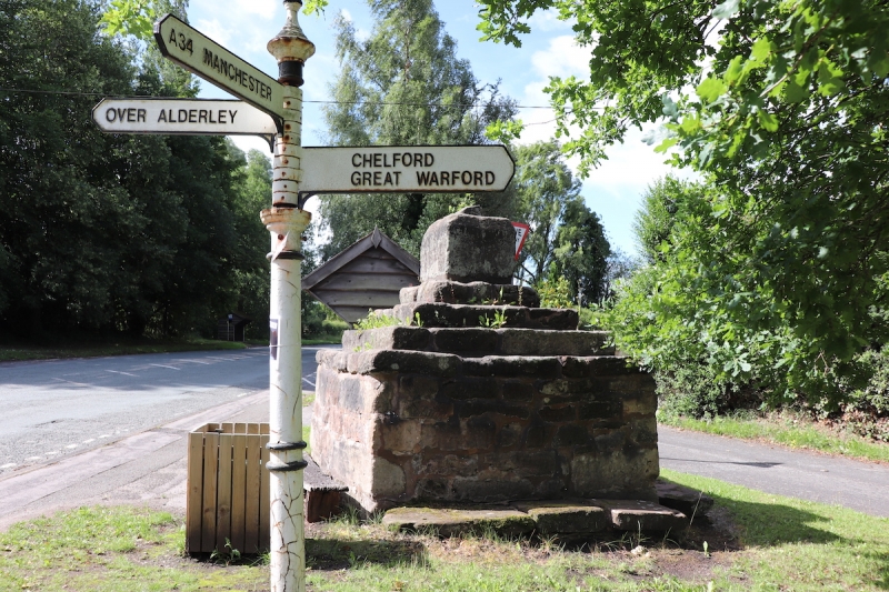
Latitude: 53.289 / 53°17'20"N
Longitude: -2.2362 / 2°14'10"W
OS Eastings: 384351
OS Northings: 376923
OS Grid: SJ843769
Mapcode National: GBR DZTD.NP
Mapcode Global: WHBBF.MLCD
Plus Code: 9C5V7QQ7+JG
Entry Name: Village Cross
Listing Date: 14 April 1967
Grade: II
Source: Historic England
Source ID: 1216839
English Heritage Legacy ID: 58289
ID on this website: 101216839
Location: Nether Alderley, Cheshire East, Cheshire, SK9
County: Cheshire East
Civil Parish: Nether Alderley
Built-Up Area: Wilmslow
Traditional County: Cheshire
Lieutenancy Area (Ceremonial County): Cheshire
Church of England Parish: Alderley St Mary
Church of England Diocese: Chester
SJ 87 NW NETHER ALDERLEY C.P. CONGLETON ROAD (West Side)
4/122 Village Cross
14/4/1967
GV II
Village Cross: Medieval. Buff and red sandstone blocks. Massive square base supports 3 graduated square steps on which stands cube-shaped block with a chamfered top into which is set the broken end of a square shaft. There are heavy stone slabs around 3 sides of the base and a wooden seat against the east side.
Listing NGR: SJ8435176923


Other nearby listed buildings