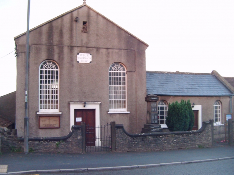
Latitude: 51.452 / 51°27'7"N
Longitude: -2.423 / 2°25'22"W
OS Eastings: 370700
OS Northings: 172642
OS Grid: ST707726
Mapcode National: GBR JY.MR7L
Mapcode Global: VH88Q.YRDR
Plus Code: 9C3VFH2G+RQ
Entry Name: Wick Tabernacle
Listing Date: 15 August 1985
Grade: II
Source: Historic England
Source ID: 1216420
English Heritage Legacy ID: 401807
ID on this website: 101216420
Location: Wick, South Gloucestershire, BS30
County: South Gloucestershire
Civil Parish: Wick and Abson
Built-Up Area: Wick
Traditional County: Gloucestershire
Lieutenancy Area (Ceremonial County): Gloucestershire
Church of England Parish: Wick
Church of England Diocese: Bristol
Tagged with: Architectural structure
ST 77 SW WICK AND ABSON C.P. HIGH STREET (south side)
8/400 Wick Tabernacle
- II
Chapel. Dated 1837 with later alterations. Rendered, slate roofs with raised coped verges. 2 storeys and 2 windows, central double panelled doors in flat architrave with cornice, 2 tall round-headed windows, multi-pane with splayed glazing bars at head, lancet with bell louvres in gable, quoin strips, shaped datestone and spike finial. Attached to right a single storey wing with 2 smaller similar windows, central smaller similar door without cornice. Right return has 3 gabled wings of different sizes, all single storey, each with similar tall round-headed window. Left return has 2 similar windows and single storey addition to rear with pitched roof. Rear has similar window in gable end, ground floor to left has C20 window, basement level has 3 doors and 3 C20 windows. Interior: not inspected.
Listing NGR: ST7070072642
External links are from the relevant listing authority and, where applicable, Wikidata. Wikidata IDs may be related buildings as well as this specific building. If you want to add or update a link, you will need to do so by editing the Wikidata entry.


Other nearby listed buildings