Latitude: 51.4719 / 51°28'18"N
Longitude: -2.4261 / 2°25'33"W
OS Eastings: 370503
OS Northings: 174857
OS Grid: ST705748
Mapcode National: GBR JY.LJFT
Mapcode Global: VH88Q.W8TG
Plus Code: 9C3VFHCF+QH
Entry Name: Wall, Gate and Piers About 10 Metres West of Church Farmhouse
Listing Date: 15 August 1985
Grade: II
Source: Historic England
Source ID: 1216224
English Heritage Legacy ID: 401464
ID on this website: 101216224
Location: Abson, South Gloucestershire, BS30
County: South Gloucestershire
Civil Parish: Wick and Abson
Traditional County: Gloucestershire
Lieutenancy Area (Ceremonial County): Gloucestershire
Church of England Parish: Pucklechurch and Abson
Church of England Diocese: Bristol
ST 77 SW
8/377
WICK AND ABSON C.P.
ABSON
Wall, gate and piers about 10 metres west of Church Farmhouse
G.V.
II
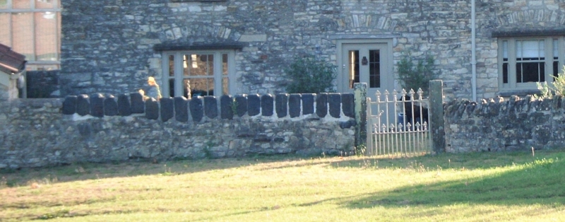
Wall, gate and piers. C18/early C19. Random limestone rubble wall with heavy
slag block coping, cast iron gate. Wall about 4 metres long and about one metre
high, cast iron gate with trefoil finials to rails, plain round-headed pier to
each side.
Listing NGR: ST7050374857
External links are from the relevant listing authority and, where applicable, Wikidata. Wikidata IDs may be related buildings as well as this specific building. If you want to add or update a link, you will need to do so by editing the Wikidata entry.


Other nearby listed buildings