Latitude: 50.792 / 50°47'31"N
Longitude: -2.7537 / 2°45'13"W
OS Eastings: 346971
OS Northings: 99428
OS Grid: SY469994
Mapcode National: GBR MJ.ZD5Q
Mapcode Global: FRA 5730.5A5
Plus Code: 9C2VQ6RW+QG
Entry Name: The Old Rectory
Listing Date: 4 December 1951
Last Amended: 31 July 1984
Grade: II
Source: Historic England
Source ID: 1216208
English Heritage Legacy ID: 401540
ID on this website: 101216208
Location: Netherbury, Dorset, DT6
County: Dorset
Civil Parish: Netherbury
Built-Up Area: Netherbury
Traditional County: Dorset
Lieutenancy Area (Ceremonial County): Dorset
Church of England Parish: Netherbury St Mary
Church of England Diocese: Salisbury
Tagged with: Clergy house
SY 4699/4799 NETHERBURY TOWER HILL 4-12-1951 10/174 The Old Rectory (formerly listed as The Old Vicarage)
GV II
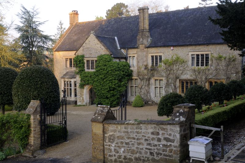
Former Rectory, now private house. C16 and C17 block, extensively altered and modernised. Late C17 porch, modernised. Early C18 south-west wing. Rubble-stone walls. Slate roof with stone gable- copings. Stacks, at left hand gable, right hand gables rebuilt in C20. Coupled front eaves stack, C19. Flat tablet below with raised label over, C20. 2 storeys. 5 windows, one 3-light stone mullion with 4-centred heads; one 4-light stone mullion with straight shanks and bowtells, both C16. Iron casements with lead lights. 3 tension bars. Remainder: cross-transomed stone-mullioned windows replace early C19 sashes. Labels over. One canted bay at left hand ground. Large 2-storey porch with pointed segmental arches on 3 sides. C20 pyramid-stopped jambs. Front door, round-headed, plank-and-muntin, C20. Victorian wing to north-west. 2 storeys, c.4 windows, now garage and stable, with cellars under. Source: R.C.H.M. Dorset I, p 174(5).
Listing NGR: SY4697199428
External links are from the relevant listing authority and, where applicable, Wikidata. Wikidata IDs may be related buildings as well as this specific building. If you want to add or update a link, you will need to do so by editing the Wikidata entry.


Other nearby listed buildings