Latitude: 52.617 / 52°37'1"N
Longitude: -0.6838 / 0°41'1"W
OS Eastings: 489204
OS Northings: 302944
OS Grid: SK892029
Mapcode National: GBR DTK.V8K
Mapcode Global: WHGM0.GHL4
Plus Code: 9C4XJ888+QF
Entry Name: Kings Arms Public House
Listing Date: 10 November 1955
Grade: II
Source: Historic England
Source ID: 1215834
English Heritage Legacy ID: 401119
Also known as: Kings Arms Inn
ID on this website: 101215834
SK 80 SE WING TOP STREET (South side)
4/156 Kings Arms Public House
10.11.55
GV II
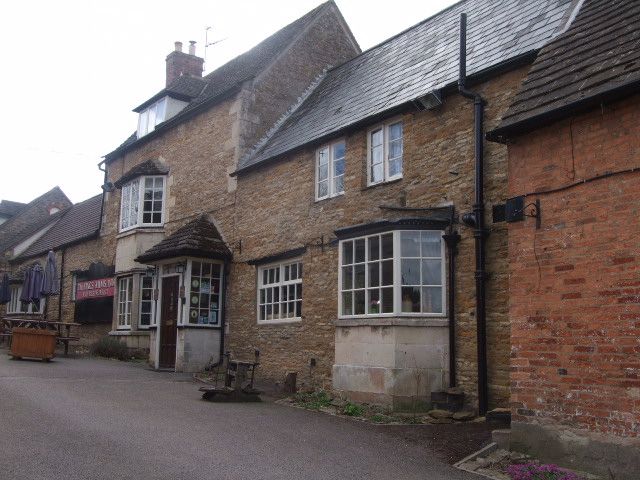
Inn, comprising a row of three buildings which may always have been functionally related, gable end to street. The oldest (middle) part is dated 1694. Coursed rubble with stone tiled roof. The northern most section is 1½ storeys, with a gambrel roof and a 3-light casement with chamfered timber lintel in the gable wall. Thin exposed timbers in the gable itself. The next section is higher, dated with the initials R over SA and a stone beneath the gable stack. The front of this part contains a canted bay to the right, of ashlar, but with timber mullions, and to the left a new window in old opening with chamfered timber lintel, and an ovolo moulded mullioned light to cellar below. Casement windows to first floor. Coped gable. Southern most section is tallest and contains a full height ashlar bay window with wood casements, and doorway to right. Brick gable stack. Small single storey barn adjoins it to the left.
Listing NGR: SK8920402944
External links are from the relevant listing authority and, where applicable, Wikidata. Wikidata IDs may be related buildings as well as this specific building. If you want to add or update a link, you will need to do so by editing the Wikidata entry.


Other nearby listed buildings