Latitude: 51.5143 / 51°30'51"N
Longitude: -2.4386 / 2°26'19"W
OS Eastings: 369657
OS Northings: 179574
OS Grid: ST696795
Mapcode National: GBR JY.HTHS
Mapcode Global: VH88J.P64H
Plus Code: 9C3VGH76+PG
Entry Name: Brice's Farmhouse
Listing Date: 17 September 1952
Grade: II
Source: Historic England
Source ID: 1215682
English Heritage Legacy ID: 400830
ID on this website: 101215682
Location: Westerleigh, South Gloucestershire, BS37
County: South Gloucestershire
Civil Parish: Westerleigh
Built-Up Area: Westerleigh
Traditional County: Gloucestershire
Lieutenancy Area (Ceremonial County): Gloucestershire
Church of England Parish: Yate
Church of England Diocese: Bristol
Tagged with: Farmhouse
ST 67 NE WESTERLEIGH C.P. CHURCH ROAD (south side)
4/341 Brice's Farmhouse 17.9.52 - II
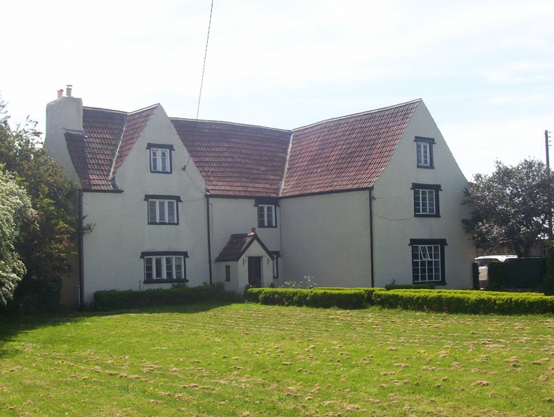
Farmhouse. C17, with C19 and C20 alterations and additions. Rubble, roughcast, double Roman tiled roof with gable stack to left and stack rising from eaves to right. L-plan formed by wing projecting to right. 2½ storeys, 2 windows to left and one in wing; ground floor has 4-light casement with heavy ovolo-moulded wooden mullions, king mullion and hood mould, similar 2-light casement to right, C19 gabled porch between with C20 outer and inner doors; first floor has 3-light casement and 2-light casement under eaves to right, large gable rising to ridge height to left with similar 2-light casement. Large 2½ storey wing to right has ground floor C19 8-light mullion and transom window with hood mould, similar 3-light casement at first floor and 2-light at attic. Right return has 2 C20 windows at ground floor, one at first floor under eaves. Rear has single storey C20 extension to left, all C20 windows, 4 at first floor, 2 gables rising to ridge height, with C20 window in gable to left. Interior: front left room has heavy chamfered beams with scroll stops. Open-well stair to rear, rising to attic level, has newel posts with moulded finials with carved fleur-de-lys, moulded grip handrail, splat balusters (some missing at upper flight), moulded risers.
Listing NGR: ST6965779574
External links are from the relevant listing authority and, where applicable, Wikidata. Wikidata IDs may be related buildings as well as this specific building. If you want to add or update a link, you will need to do so by editing the Wikidata entry.


Other nearby listed buildings