Latitude: 54.0502 / 54°3'0"N
Longitude: -2.8043 / 2°48'15"W
OS Eastings: 347440
OS Northings: 461881
OS Grid: SD474618
Mapcode National: GBR 8PVL.PW
Mapcode Global: WH846.WGTD
Plus Code: 9C6V352W+37
Entry Name: 1-9, St Marys Parade
Listing Date: 18 February 1970
Grade: II
Source: Historic England
Source ID: 1214351
English Heritage Legacy ID: 383323
ID on this website: 101214351
Location: Lancaster, Lancashire, LA1
County: Lancashire
District: Lancaster
Electoral Ward/Division: Castle
Parish: Non Civil Parish
Built-Up Area: Lancaster
Traditional County: Lancashire
Lieutenancy Area (Ceremonial County): Lancashire
Church of England Parish: Lancaster St Mary with St John and St Anne
Church of England Diocese: Blackburn
Tagged with: Building
LANCASTER
SD4761NW ST MARY'S PARADE 1685-1/6/289 (East side) 18/02/70 Nos.1-9 (Odd)
GV II
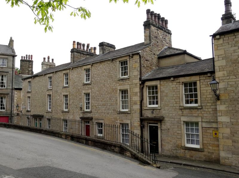
Five houses. Mid C19. Squared coursed sandstone with slate roofs. Nos 1-5 and the left-hand bay of Nos 7 & 9 form a row of 3 storeys and 5 bays. The windows are glazing bar sashes with plain stone surrounds. Between the 1st and 2nd bays are paired doorways to Nos 1 & 3, with plain stone surrounds, cornice hoods, and 6-panel doors. The single doorway to No.5 is in the 3rd bay. To its right is a sashed window with a stone surround, probably a later alteration. The gutter is supported on stone corbels. Chimneys on gables and between bays 2 & 3 and bays 3 & 4. Part of Nos 7 & 9, at the right, is set back slightly and is of 2 storeys and 2 bays. The windows are similar to those of the main block, as is the doorway, which is in the left-hand bay. A projection rising above the ridge of the roof and abutting the gable of the taller part of the building contains a staircase. HISTORY: buildings shown on the site on the 5 feet to one mile OS map surveyed in 1845 differ in shape from the present houses, suggesting that they were built shortly after that date.
Listing NGR: SD4744261887
External links are from the relevant listing authority and, where applicable, Wikidata. Wikidata IDs may be related buildings as well as this specific building. If you want to add or update a link, you will need to do so by editing the Wikidata entry.


Other nearby listed buildings