Latitude: 52.805 / 52°48'17"N
Longitude: -1.6279 / 1°37'40"W
OS Eastings: 425179
OS Northings: 323114
OS Grid: SK251231
Mapcode National: GBR 5DW.37B
Mapcode Global: WHCG5.YRYH
Plus Code: 9C4WR93C+XR
Entry Name: 65, High Street
Listing Date: 22 June 1979
Grade: II
Source: Historic England
Source ID: 1213674
English Heritage Legacy ID: 272968
ID on this website: 101213674
Location: Bond End, East Staffordshire, DE14
County: Staffordshire
District: East Staffordshire
Civil Parish: Burton
Built-Up Area: Burton upon Trent
Traditional County: Staffordshire
Lieutenancy Area (Ceremonial County): Staffordshire
Church of England Parish: Burton-on-Trent St Chad
Church of England Diocese: Lichfield
Tagged with: Building
HIGH STREET 1. (West Side) 5369 No 65 SK 2523 SW 1/14
II GV
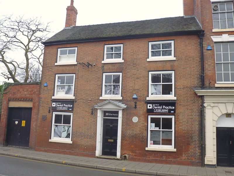
2. Late C18. Red brick; 3 storeys; 3 sash windows (no glazing bars) in moulded wood frames; moulded wood doorcase with plain rectangular fanlight and pediment; moulded wood eaves; old tiles.
Listing NGR: SK2517923114
External links are from the relevant listing authority and, where applicable, Wikidata. Wikidata IDs may be related buildings as well as this specific building. If you want to add or update a link, you will need to do so by editing the Wikidata entry.


Other nearby listed buildings