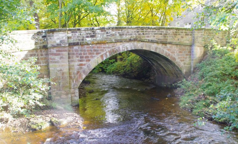
Latitude: 54.3522 / 54°21'8"N
Longitude: -0.8868 / 0°53'12"W
OS Eastings: 472452
OS Northings: 495761
OS Grid: SE724957
Mapcode National: GBR QL73.TL
Mapcode Global: WHF98.BVZW
Plus Code: 9C6X9427+V7
Entry Name: Bow Bridge
Listing Date: 27 August 1987
Grade: II
Source: Historic England
Source ID: 1213659
English Heritage Legacy ID: 382462
ID on this website: 101213659
Location: Rosedale Abbey, North Yorkshire, YO18
County: North Yorkshire
District: Ryedale
Civil Parish: Rosedale East Side
Traditional County: Yorkshire
Lieutenancy Area (Ceremonial County): North Yorkshire
Tagged with: Bridge
5340
SE 7295
16/44
NORTH YORKSHIRE
RYEDALE
ROSEDALE EAST SIDE
ROSEDALE ABBEY
Bow Bridge
II
Bridge. Late C18. Herringbone-tooled sandstone. Single span. Segmental
arch of voussoirs flanked by pilaster buttresses. Continuous impost band
beneath plain parapet, raked to centre. Buttresses rise into parapet to
form rectangular piers; square-section terminal piers. Cambered coping with
low pyramidal caps to terminal piers.
Listing NGR: SE7245295761
External links are from the relevant listing authority and, where applicable, Wikidata. Wikidata IDs may be related buildings as well as this specific building. If you want to add or update a link, you will need to do so by editing the Wikidata entry.


Other nearby listed buildings