Latitude: 51.7837 / 51°47'1"N
Longitude: -1.4897 / 1°29'22"W
OS Eastings: 435299
OS Northings: 209575
OS Grid: SP352095
Mapcode National: GBR 6VS.266
Mapcode Global: VHC02.4FBF
Plus Code: 9C3WQGM6+F4
Entry Name: 61, Corn Street
Listing Date: 6 February 1970
Grade: II
Source: Historic England
Source ID: 1212938
English Heritage Legacy ID: 397474
ID on this website: 101212938
Location: Witney, West Oxfordshire, OX28
County: Oxfordshire
District: West Oxfordshire
Civil Parish: Witney
Built-Up Area: Witney
Traditional County: Oxfordshire
Lieutenancy Area (Ceremonial County): Oxfordshire
Church of England Parish: Witney
Church of England Diocese: Oxford
Tagged with: Building
This list entry was subject to a Minor Amendment on 25 April 2025 to update the Name and Address and reformat the text to current standards
SP3509N
10/139
WITNEY
CORN STREET (South side)
No 61
(Formerly listed as No.63)
06/02/70
GV
II
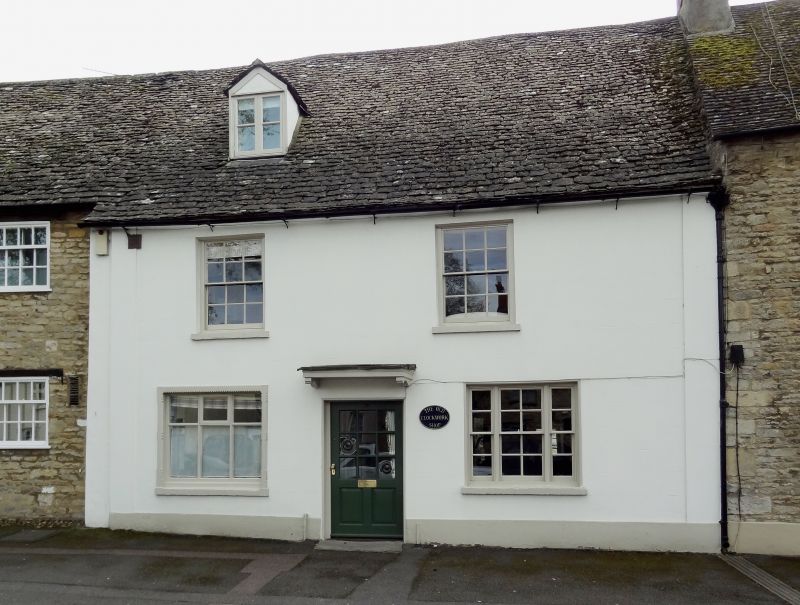
House. C17; refronted late C18. Coursed limestone rubble; gabled stone slate roof; rear lateral stack of stone finished in brick. Two-unit through-passage plan. Two storeys and attic; two-window range. C20 door with C19 bracketed flat hood. Tripartite horned sash to right of door C20 window to left; first-floor six-pane sashes. Gabled roof dormer.
Rear: later C18 outshut adjoins two-storey, one-bay range to left containing large bread oven.
Interior: C18 plank partition to right. Room to left has heavy chamfered beam and chamfered bressumer over large open fireplace. Stone quarter-turn stairs to rear. C17 and C18 butt-purlin roofs.
Listing NGR: SP3529909575
External links are from the relevant listing authority and, where applicable, Wikidata. Wikidata IDs may be related buildings as well as this specific building. If you want to add or update a link, you will need to do so by editing the Wikidata entry.


Other nearby listed buildings