Latitude: 51.4885 / 51°29'18"N
Longitude: -2.4325 / 2°25'56"W
OS Eastings: 370068
OS Northings: 176707
OS Grid: ST700767
Mapcode National: GBR JY.KGTL
Mapcode Global: VH88J.SVD8
Plus Code: 9C3VFHQ9+C2
Entry Name: Harwood Farmhouse
Listing Date: 17 September 1952
Grade: II
Source: Historic England
Source ID: 1212366
English Heritage Legacy ID: 396862
ID on this website: 101212366
Location: Pucklechurch, South Gloucestershire, BS16
County: South Gloucestershire
Civil Parish: Pucklechurch
Built-Up Area: Pucklechurch
Traditional County: Gloucestershire
Lieutenancy Area (Ceremonial County): Gloucestershire
Church of England Parish: Pucklechurch and Abson
Church of England Diocese: Bristol
Tagged with: Farmhouse
ST 77 NW PUCKLECHURCH C.P. CASTLE ROAD (north east side)
5/188 Harwood Farmhouse 17.9.52 - II
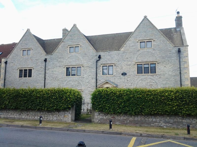
Farmhouse, now house. Late C17, C18 doorcase, refenestrated C19. Coursed limestone rubble with stone dressings and quoins, plain tiled roof with gable stacks. 2½ storeys and 4 windows, all 3-light casements with chamfered mullions, hood mould and high relieving arch, except first floor 2nd from right, similar without relieving arch, at attic level 3 large gables rising to ridge height, each with 2-light casement with hood mould; all windows have leaded lights. 2nd from right, 6-panelled door with fanlight and radial glazing bars, engaged Doric column to each side with triglyph and guttae above each column, broken pediment. Right return has 2 single light casements at ground floor with leaded lights and hood mould. Interior: not inspected.
Listing NGR: ST7006876707
External links are from the relevant listing authority and, where applicable, Wikidata. Wikidata IDs may be related buildings as well as this specific building. If you want to add or update a link, you will need to do so by editing the Wikidata entry.


Other nearby listed buildings