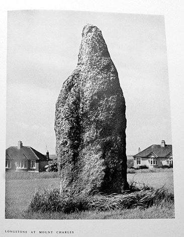
Latitude: 50.336 / 50°20'9"N
Longitude: -4.7702 / 4°46'12"W
OS Eastings: 202959
OS Northings: 52119
OS Grid: SX029521
Mapcode National: GBR N0.XBHG
Mapcode Global: FRA 08W4.Z96
Plus Code: 9C2Q86PH+9W
Entry Name: Long Stone
Listing Date: 11 March 1974
Grade: II*
Source: Historic England
Source ID: 1212080
English Heritage Legacy ID: 396594
Also known as: Standing stone called the 'Long Stone' in the grounds of Penrice School
ID on this website: 101212080
Location: Mount Charles, Cornwall, PL25
County: Cornwall
Civil Parish: St Austell
Built-Up Area: St Austell
Traditional County: Cornwall
Lieutenancy Area (Ceremonial County): Cornwall
Church of England Parish: Charlestown
Church of England Diocese: Truro
Tagged with: Menhir Architectural structure
ST AUSTELL 1. MOUNT CHARLES 1584A Long Stone SX 05 SW 9/508
II*
2. Scheduled Ancient Monument. Bronze age megalith, granite, approximately 12 ft high by 4 ft wide, tapered at top.
Listing NGR: SX0295952119
External links are from the relevant listing authority and, where applicable, Wikidata. Wikidata IDs may be related buildings as well as this specific building. If you want to add or update a link, you will need to do so by editing the Wikidata entry.


Other nearby listed buildings