Latitude: 52.4618 / 52°27'42"N
Longitude: -1.9139 / 1°54'49"W
OS Eastings: 405947
OS Northings: 284880
OS Grid: SP059848
Mapcode National: GBR 5XH.9C
Mapcode Global: VH9Z2.SD23
Plus Code: 9C4WF36P+PC
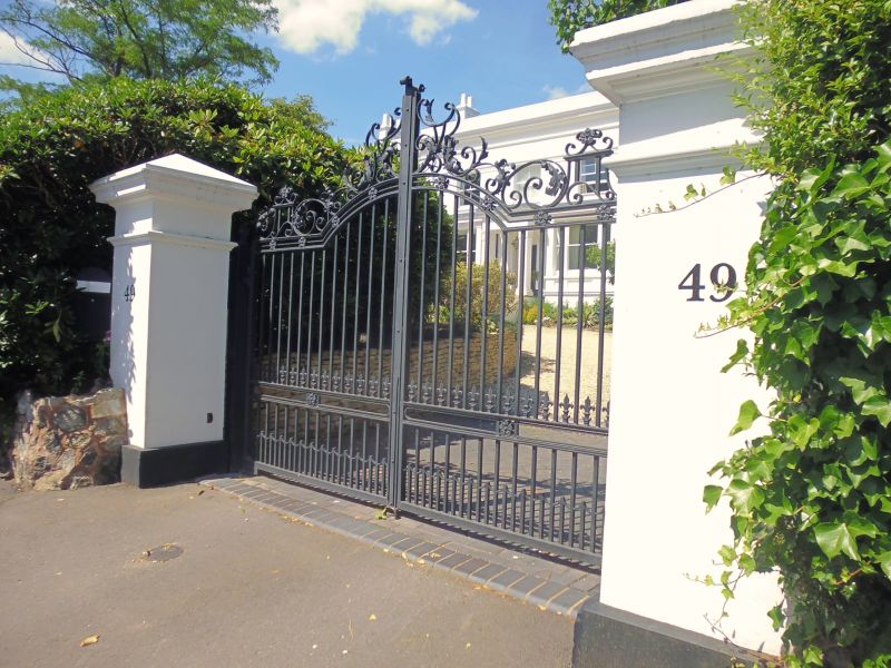
Entry Name: Gate Piers to Number 49
Listing Date: 8 July 1982
Grade: II
Source: Historic England
Source ID: 1211235
English Heritage Legacy ID: 217772
ID on this website: 101211235
Location: Birmingham, West Midlands, B15
County: Birmingham
Parish: Non Civil Parish
Built-Up Area: Birmingham
Traditional County: Warwickshire
Lieutenancy Area (Ceremonial County): West Midlands
Church of England Parish: Edgbaston St Bartholomew
Church of England Diocese: Birmingham
Tagged with: Gatepost
WELLINGTON ROAD 1. 5104 Edgbaston B15 Gate piers to No 49 SP 0584 NE 49/15 II GV 2. C1840 stucco square section gate piers at entrance to drive; moulded plinths and cornices with pyramid caps.
Listing NGR: SP0594784880
External links are from the relevant listing authority and, where applicable, Wikidata. Wikidata IDs may be related buildings as well as this specific building. If you want to add or update a link, you will need to do so by editing the Wikidata entry.


Other nearby listed buildings