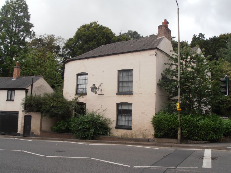
Latitude: 52.4536 / 52°27'13"N
Longitude: -1.2007 / 1°12'2"W
OS Eastings: 454412
OS Northings: 284262
OS Grid: SP544842
Mapcode National: GBR 8PP.38J
Mapcode Global: VHCTD.4LLF
Plus Code: 9C4WFQ3X+CP
Entry Name: The Springs
Listing Date: 30 September 1993
Grade: II
Source: Historic England
Source ID: 1211221
English Heritage Legacy ID: 392586
ID on this website: 101211221
Location: Lutterworth, Harborough, Leicestershire, LE17
County: Leicestershire
District: Harborough
Civil Parish: Lutterworth
Built-Up Area: Lutterworth
Traditional County: Leicestershire
Lieutenancy Area (Ceremonial County): Leicestershire
Church of England Parish: Lutterworth St Mary
Church of England Diocese: Leicester
Tagged with: Architectural structure
LUTTERWORTH STONEY HOLLOW SP5484 1323-0/9/91 (West side) The Springs GV II
House. Probably C16, extended in C18 and early C19 with minor later alterations. Timber-framed with painted brick cladding. Slate roofs. Two storeys and attic with roof hipped to south; return of roof on east and west sides with twin span roof. Ridge stack to south, C17, with end stack to north. Irregular fenestration of first and ground floors with single window in garret; mainly 12 and 16-pane sashes. Doric-columned porch in centre in slight angle between blocks with panelled door and plain fanlight over. Regular 2-window range towards Rugby Road (E), three of the windows with 16-pane hornless sashes, one a tripartitie sash, all under segment heads. Interior: exposed frame on first floor, probably C16 with heavily jowled posts. Upper crucks in roof, halved and jointed at ridge.
Listing NGR: SP5441284262
External links are from the relevant listing authority and, where applicable, Wikidata. Wikidata IDs may be related buildings as well as this specific building. If you want to add or update a link, you will need to do so by editing the Wikidata entry.


Other nearby listed buildings