Latitude: 52.2897 / 52°17'22"N
Longitude: -0.3822 / 0°22'55"W
OS Eastings: 510442
OS Northings: 266962
OS Grid: TL104669
Mapcode National: GBR H1P.D6S
Mapcode Global: VHFPJ.BQB2
Plus Code: 9C4X7JQ9+V4
Entry Name: 40, Hatchet Lane
Listing Date: 28 April 1983
Grade: II
Source: Historic England
Source ID: 1210485
English Heritage Legacy ID: 395093
ID on this website: 101210485
Location: Stonely, Huntingdonshire, Cambridgeshire, PE19
County: Cambridgeshire
District: Huntingdonshire
Civil Parish: Kimbolton
Built-Up Area: Stonely
Traditional County: Huntingdonshire
Lieutenancy Area (Ceremonial County): Cambridgeshire
Church of England Parish: Kimbolton St Andrew
Church of England Diocese: Ely
Tagged with: Building
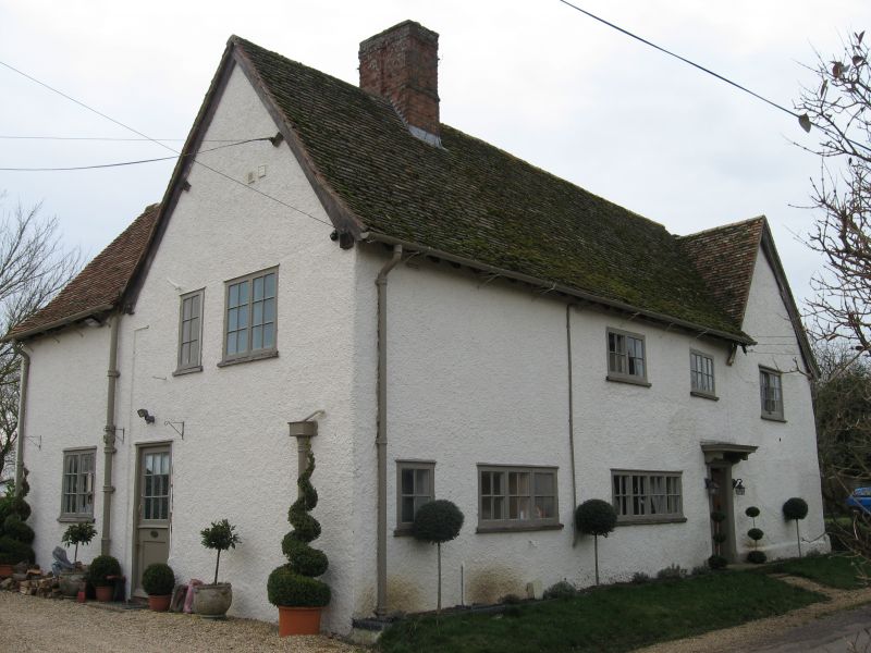
KIMBOLTON HATCHET LANE TL 16 NW STONELY (SOUTH-WEST SIDE) 4/3 NO. 40 GV II Cottage with mediaeval open hall of two bays, extended in early C17 by one bay to south-west, and two bays to north-east. Two storeys. Roughcast render to timber-frame; pantile roof, ridge stack. Modern closed porch. Four modern casement windows with leaded lights at both floor levels. Interior has exposed timber-frame, stop chamfered ceiling beams and inglenook hearth. Roof to mediaeval hall largely intact with alternate rafter pairs having collars.
Listing NGR: TL1044266962
External links are from the relevant listing authority and, where applicable, Wikidata. Wikidata IDs may be related buildings as well as this specific building. If you want to add or update a link, you will need to do so by editing the Wikidata entry.


Other nearby listed buildings