Latitude: 50.8309 / 50°49'51"N
Longitude: -0.1672 / 0°10'2"W
OS Eastings: 529165
OS Northings: 105086
OS Grid: TQ291050
Mapcode National: GBR JNX.SMM
Mapcode Global: FRA B6JW.YG0
Plus Code: 9C2XRRJM+94
Entry Name: 58, the Drive
Listing Date: 2 November 1992
Grade: II
Source: Historic England
Source ID: 1209787
English Heritage Legacy ID: 365625
ID on this website: 101209787
Location: Hove, Brighton and Hove, West Sussex, BN3
County: The City of Brighton and Hove
Electoral Ward/Division: Goldsmid
Parish: Non Civil Parish
Built-Up Area: Brighton and Hove
Traditional County: Sussex
Lieutenancy Area (Ceremonial County): East Sussex
Church of England Parish: Hove All Saints
Church of England Diocese: Chichester
Tagged with: Building
HOVE
TQ2905SW THE DRIVE 579-1/15/186 No.58
II
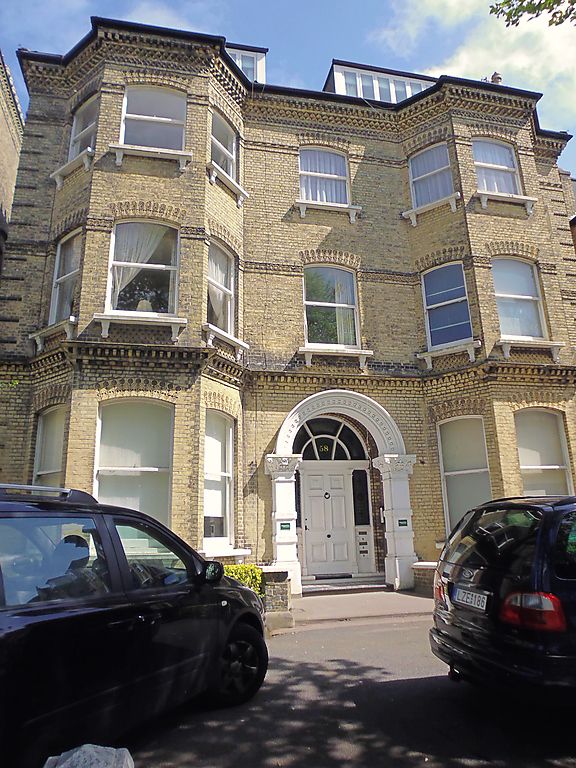
Villa. 1880's, built by William Willett. Yellow stock bricks, lavish use of moulded and incised bricks for cornices, aprons, string courses and lintels, rendered basement, slate roof with C20 dormers, central ridge and end stacks stacks forming a continuous wall. Plan: double-fronted. 2 storeys plus attic over basement, 3:1:3 bays, full-height bays flanking central bay, sash windows without glazing bars in segmental-headed openings, cills on shaped brackets, round-arched entrance carried on rusticated piers with ornate capitals, recessed panelled door with fanlight and sidelights, approached by shallow flight of steps. Forms part of a group of Willett buildings in The Drive.
Listing NGR: TQ2916805086
External links are from the relevant listing authority and, where applicable, Wikidata. Wikidata IDs may be related buildings as well as this specific building. If you want to add or update a link, you will need to do so by editing the Wikidata entry.


Other nearby listed buildings