Latitude: 52.4538 / 52°27'13"N
Longitude: -1.204 / 1°12'14"W
OS Eastings: 454192
OS Northings: 284277
OS Grid: SP541842
Mapcode National: GBR 8PP.2FZ
Mapcode Global: VHCTD.2LW9
Plus Code: 9C4WFQ3W+GC
Entry Name: Hythe House
Listing Date: 11 January 1955
Grade: II
Source: Historic England
Source ID: 1209177
English Heritage Legacy ID: 392593
ID on this website: 101209177
Location: Lutterworth, Harborough, Leicestershire, LE17
County: Leicestershire
District: Harborough
Civil Parish: Lutterworth
Built-Up Area: Lutterworth
Traditional County: Leicestershire
Lieutenancy Area (Ceremonial County): Leicestershire
Church of England Parish: Lutterworth St Mary
Church of England Diocese: Leicester
Tagged with: House
LUTTERWORTH WOODMARKET SP5484 1323-0/9/98 (North side) 11/01/55 No.68 Hythe House GV II
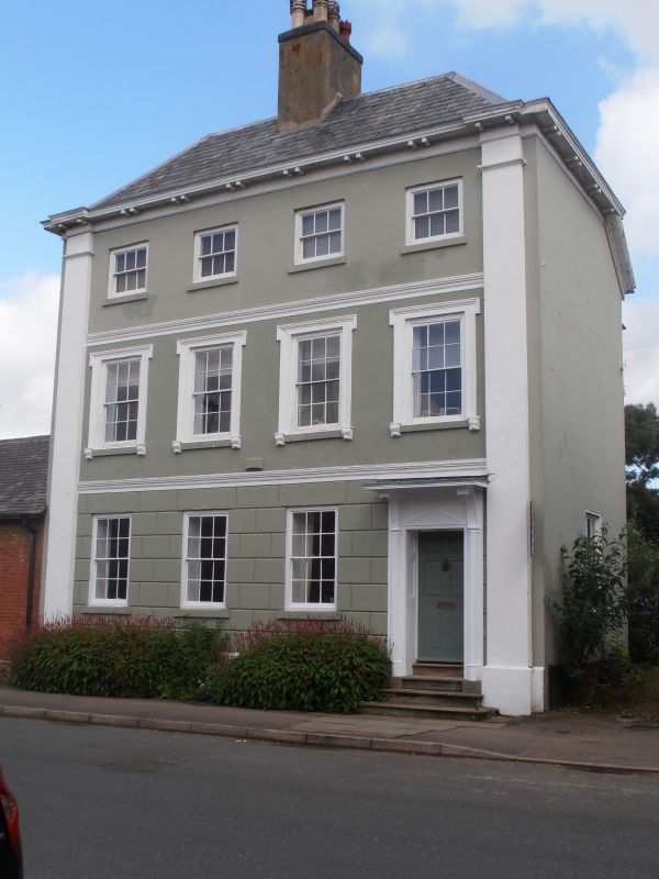
House. Early-C19, with minor later alterations. Stuccoed with rusticated ground floor; slate hipped roof with large central ridge stack. Three storeys on plinth, with moulded stuccoed bands over ground and first floors and colossal stuccoed pilaster-quoins. Boldly projecting wooden eaves cornice with paired brackets. Four window front, 6 and 12-pane hornless sashes, on second floor shallower than below, on first floor in stuccoed moulded and eared surrounds. Recessed entrance to right with panelled door and blind transom-light over in panelled reveals and slim half-columned surround with cornice-hood over, all up three steps. Two-storey wings to rear, Tall round-headed stair window. Interior: open-well stair with turned balusters and ramped rail, and associated ramped panelled dado. One of the best and most intact town houses of its date in Lutterworth.
Listing NGR: SP5419284277
External links are from the relevant listing authority and, where applicable, Wikidata. Wikidata IDs may be related buildings as well as this specific building. If you want to add or update a link, you will need to do so by editing the Wikidata entry.


Other nearby listed buildings