Latitude: 51.2862 / 51°17'10"N
Longitude: 0.4011 / 0°24'3"E
OS Eastings: 567534
OS Northings: 156857
OS Grid: TQ675568
Mapcode National: GBR NPK.675
Mapcode Global: VHJM4.WXWW
Plus Code: 9F327CP2+FC
Entry Name: St Leonard's House
Listing Date: 1 August 1952
Grade: II
Source: Historic England
Source ID: 1209125
English Heritage Legacy ID: 392445
ID on this website: 101209125
Location: St Leonard's Street, Tonbridge and Malling, Kent, ME19
County: Kent
District: Tonbridge and Malling
Civil Parish: West Malling
Traditional County: Kent
Lieutenancy Area (Ceremonial County): Kent
Church of England Parish: West Malling St Mary
Church of England Diocese: Rochester
Tagged with: House
WEST MALLING
TQ65NE ST LEONARDS STREET 1156-0/1/133 St Leonard's House 01/08/52
GV II
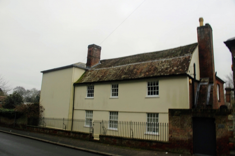
House. Early C19 standing at right-angles to the road. Rendered with hipped slate roof. 2 storeys 5 windows. Sashes with round-headed window to centre 1st floor. Central panelled door (up 3 steps) with top lights and rectangular fanlight in panelled pilastered doorcase with flat projecting hood. The pilasters have diamond-shaped panelled capitals and there is a diaper frieze below the hood. Very slender eaves on elevation with wide overhang. Gutter lead flashed through with timber fascia and eaves board faced with an ogee timber moulding on the fascia with lead dressed over the top edge. Additional 2-storey structure at right-angles to the main building running parallel with the road. 2 storeys 3 windows. Sliding sashes. Central ground floor window probably a built-out doorcase. Wrought-iron spear railings with gate in the centre.
Listing NGR: TQ6775057329
External links are from the relevant listing authority and, where applicable, Wikidata. Wikidata IDs may be related buildings as well as this specific building. If you want to add or update a link, you will need to do so by editing the Wikidata entry.


Other nearby listed buildings