Latitude: 51.6624 / 51°39'44"N
Longitude: 0.2273 / 0°13'38"E
OS Eastings: 554145
OS Northings: 198303
OS Grid: TQ541983
Mapcode National: GBR V1.V9N
Mapcode Global: VHHMV.WGJZ
Plus Code: 9F32M66G+WW
Entry Name: Navestock Hall
Listing Date: 27 August 1952
Last Amended: 9 December 1994
Grade: II
Source: Historic England
Source ID: 1208652
English Heritage Legacy ID: 373792
ID on this website: 101208652
Location: Brentwood, Essex, RM4
County: Essex
District: Brentwood
Civil Parish: Navestock
Traditional County: Essex
Lieutenancy Area (Ceremonial County): Essex
Church of England Parish: Navestock St Thomas
Church of England Diocese: Chelmsford
Tagged with: House
NAVESTOCK
TQ59NW SHONKS MILL ROAD 723-1/4/514 (North side) 27/08/52 Navestock Hall (Formerly Listed as: BRENTWOOD SHONKS MILL ROAD, Navestock Navestock Hall)
GV II
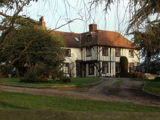
House. Early C16. Exposed timber-framing and peg-tiled roof. Later additions and major rebuilding after bomb damage in Sept 1940. 2 storeys and attics. SW block has original first floor jettied to N and S using flat laid joists with soffit tenons. Drastically restored side walls but bracing may copy original. The S face has a projecting timber-framed, gabled bay of C20 build. INTERIOR: NE block C17 principal ceiling joists have lamb's tongue stopped chamfers. Between these 2 blocks is a large chimney-stack and small C18 staircase with turned softwood balusters. NW block probably C18 but extensively rebuilt. Rain water head dated 1767 on SE front. Navestock Hall, the granary (qv) and the stable (qv) form a group. (RCHM: Central and SW Essex : Monument 5: 193).
Listing NGR: TQ5414598303
External links are from the relevant listing authority and, where applicable, Wikidata. Wikidata IDs may be related buildings as well as this specific building. If you want to add or update a link, you will need to do so by editing the Wikidata entry.


Other nearby listed buildings