Latitude: 52.2034 / 52°12'12"N
Longitude: -3.0307 / 3°1'50"W
OS Eastings: 329659
OS Northings: 256633
OS Grid: SO296566
Mapcode National: GBR F5.36W1
Mapcode Global: VH778.FW47
Plus Code: 9C4R6X39+9P
Entry Name: Wattle Cottage
Listing Date: 7 August 1972
Last Amended: 31 December 1993
Grade: II
Source: Historic England
Source ID: 1208521
English Heritage Legacy ID: 385872
ID on this website: 101208521
Location: Kington, County of Herefordshire, HR5
County: County of Herefordshire
Civil Parish: Kington
Built-Up Area: Kington
Traditional County: Herefordshire
Lieutenancy Area (Ceremonial County): Herefordshire
Church of England Parish: Kington
Church of England Diocese: Hereford
Tagged with: Cottage
KINGTON
SO2956 HIGH STREET 643-1/1/108 (North West side) 07/08/72 Nos.20, 21 and Wattle Cottage (Formerly Listed as: HIGH STREET (North West side) No.21)
GV II
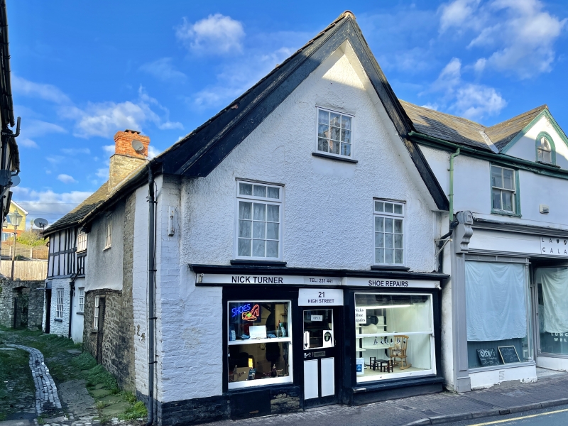
Shops and dwellings. C17. Coursed rubble; roughcast; stucco; Welsh slate roof, with C20 composite tile gable to left. 2 storeys, attic and cellars; 4-window range: to right, C20 2/2 sashes with round-headed light in gable, over; to left, C20 lights, with C20 light to gable. Early C20 shopfront to right, with central part-glazed double-doors recessed between plate-glass windows with canted returns; to left, early C20 shopfront with central half-glazed door, flanked by plain sashes. Right returned side: leaded light. Left returned side: rubble; roughcast to 1st floor; C20 entrance and casement over. Wing to rear (Wattle Cottage): late C17 timber-framing, with stone tile roof and central rubble ridge stack; C20 doors and casements. INTERIOR: No.21: exposed ceiling beams, some chamfered; C17 timber-framing; collared trusses; altered roof pitch to north-east; C20-inserted dogleg staircase with barley-sugar twist balusters.
Listing NGR: SO2966656632
External links are from the relevant listing authority and, where applicable, Wikidata. Wikidata IDs may be related buildings as well as this specific building. If you want to add or update a link, you will need to do so by editing the Wikidata entry.


Other nearby listed buildings